
Ord, Edward Otho Cresap
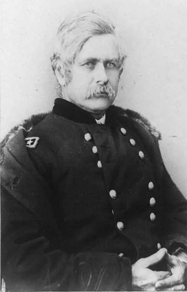
Edward Otho Cresap Ord (October 18, 1818 - July 22, 1883) was an American army officer and engineer active in California in the mid to late 19th century. He was born in Cumberland, Maryland. According to family lore, his father, James Ord, was the illegitimate son of British monarch George VI and Maria Fitzherbert. He showed an early proficiency in mathematics, some calling him a genius, and in 1839 he graduated from West Point with an engineering degree. As it so happened, his West Point roommate was none other than William Tecumseh Sherman. He was commissioned as a Lieutenant in the 3rd U.S. Artillery, with whom he saw action in the Second Seminole War (1835 - 1842). After the Mexican-American War (1846 - 1848) Ord sailed on the USS Lexington via Cape Horn to the newly acquired territory of California - accompanying him were his West Point roomies Henry Halleck and William Tecumseh Sherman. They arrived just in time for the Gold Rush. Ord produced a seminal map of the Gold and Quicksilver district of California dated July 25, 1848 - the first published map of the California Gold Region. Later in the fall of 1848, Ord and Sherman, working for John Augustus Sutter, Jr., assisted the U.S. Army Corps of Engineers in a detailed survey of Sacramento - instrumental in creating that city's downtown grid. He went on to do survey work in the vicinity of Los Angeles and the Pacific Northwest. At the outbreak of the American Civil War (1861 - 1865), Ord was serving as Captain of Battery C, 3rd U.S. Artillery, and also as post commander at the U.S. Army's Fort Vancouver in Washington Territory. Returning east to fight in the war, he was assigned brigade commander of the Pennsylvania Reserves. He served with distinction through the war, seeing action at Dranesville, Hatchie Bridge, Luka, and Vicksburg, Crater, and Fort Harrison, where he was wounded. At the end of the Civil War, in 1865, Ord was assigned to investigate Confederate involvement in the assassination of Abraham Lincoln. By this time, Ord was a Major General. He retired from the army in 1881 to take a position under U. S. Grant as a civil engineer on the Mexican Southern Railroad. During this assignment, Ord's daughter, Roberta, married prominent Mexican general Jerónimo Treviño. Also in Mexico, Ord contracted yellow fever and died on his way home during a stopover in Havanna, Cuba.
'...most important of all the maps of 1848,' -Wheat
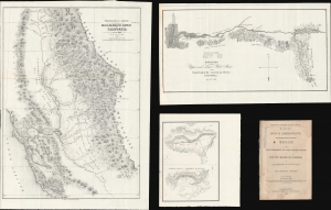
Topographical Sketch of the Gold and Quicksilver District of California. / Positions of the Upper and Lower Gold Mines on the South Fork of the American River, California. / Upper Mines. / Lower Mines or Mormon Diggings.
$2,250.00
Acquire
- Digital Map Information
- Suitable for large format printing
- Full resolution TIFF file
- ICC color profile embedded
- Delivered instantly via download link
This is a series of three 1848 maps by E. O. C. Ord of the gold discoveries in California's Sacramento Valley. These are, in aggregate, the first and most significant early maps illustrating the 1849 California Gold Rush, compiled to introduce the gold discovery to the U.S. Congress. As noted by Wheat, these were 'the first map[s] to make any pretense at cartographic accuracy after the gold discoveries,' thus being 'the most important of all the maps of 1848 . . . of paramount importance in any cartographical consideration of the gold rush.' The maps accompany Ex. Doc. No. 1, issued for the House of Representatives. (more details)