
Roe, Frederick B.

Frederick B. Roe (1845 – April, 1905) was an American civil engineer and map publisher. Roe was born in Brookfield, Connecticut. Roe was of a generation of cartographers, along with Henry Walling, Frederick Beers, George Colby, J. N Stuart, and others who, taking advantage of the lithography printing revolution, traveled throughout the United States mapping and publishing large scale town and county maps. These were generally sold by subscription and were often printed only in very small runs. Roe seems to have been primarily based in Philadelphia, which was then an important map printing center, but he traveled extensively. He also lived for a time in Reading Pennsylvania, where he served a term on the Common Council. He also lived for a time in Wilmington, Delaware, where he lived while working on a detailed wall map of that region. Roe partnered with George N. Colby in 1873 to issue wall maps of several towns in Maine including New Brunswick, Thomaston, Bath, and Camden. This partnership lasted until about 1878 and maintained offices in Philadelphia at 31 South 6th Street. Later he moved his offices to 17 North 6th Street, Philadelphia. Among his more important works is a detail city plan of Duluth, Minnesota, published with Albertson and Chamberlain. He died in Cincinnati in the last week of April, 1905.
Powerhouse of American Shipbuilding.
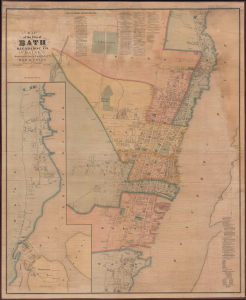
Map of the City of Bath Sagadahoc Co. Maine.
$3,500.00
Acquire
- Digital Map Information
- Suitable for large format printing
- Full resolution TIFF file
- ICC color profile embedded
- Delivered instantly via download link
This is a scarce 1873 wall map of Bath, Maine, prepared by local cartographers Frederick B. Roe and George N. Colby. The map is notable for documenting the city's importance as a center of the American shipbuilding industry. (more details)
One of only two known examples of Colby and Roe's map of Camden, Maine.
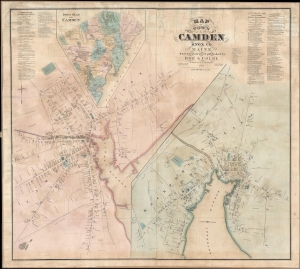
Map of the Town of Camden Knox Co. Maine.
$2,500.00
Acquire
- Digital Map Information
- Suitable for large format printing
- File Size: 43.9 MB
- File Type: ZIP / TIFF
- ICC color profile embedded
- Delivered instantly via download link
A discovery of exceptional rarity, this is Frederick B. Roe and George Nehemiah Colby's 1875 map of Camden, Maine. This is the best and finest map of Camden to appear in the 19th century. It superseded the 1856 E. M. Woodford map of the same region both in terms of size and level of detail. (more details)