
Tessan, Urban Dortet de
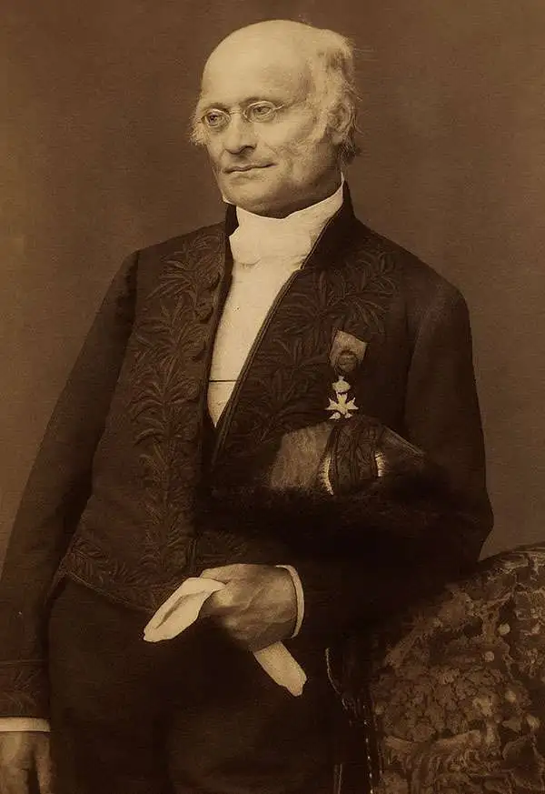
Urbain Dortet de L'Espigarié de Tessan (August 25, 1804 - September 30, 1879) was a French physicist and Hydrographer Engineer active in Paris during the early to middle part of the 19th century. Tessan was considered among the most scientific of cartographers active at the time, and his work is notable for its meticulousness and precision. Tessan was born in Vigan, the scion of an old Languedoc family. He graduated from the École Polytechnique in 1825. On graduation, he was placed in the command of Beautemps-Beaupré (1824), under whom he participated in the Gironde estuary campaigns (surveying shifting sandbanks) and Bayonne (1825 - 26), before conducting seabed surveys at Saint-Malo and Saint-Brieuc. He was then reassigned to Lieutenant Commander A. Bérard of the brig Le Loiret; with whom he mapped the Algerian coast, devising in the process a new technique for offshore surveying (1831 - 33). From 1836 to 1839, he participated as expedition meteorlogist on the Abel Aubert Dupetit-Thouars (1793 - 1864) expedition, a scientific-naval westward circumnavigation of the globe on the frigate Vénus. After the circumnavigation, he worked mostly in and around France, retiring in 1852 as a first-class engineer. In 1861, he was voted a full member of l'Académie des Sciences. Tessan published several important works on physics, hydrography, astronomy, and more. Some of his more significant research presaged the invention of sonar over one hundred years later.
Second earliest, and earliest obtainable scientific map of the Galapagos.
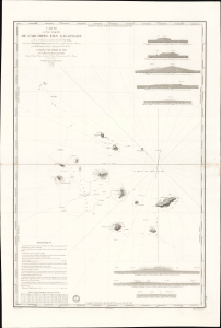
Carte d'une Partie de L'Archipel des Galapagos Levée et dressée en 1838 à bord de la Vénus...
$7,500.00
Acquire
- Digital Map Information
- Suitable for large format printing
- File Size: 2032.23 MB
- File Type: ZIP / TIFF
- ICC color profile embedded
- Delivered instantly via download link
An extraordinary discovery, this is Urbain Dortet de Tessan's 1842 nautical map of the Galapagos Islands, considered the second scientific map of the Galapagos. The map is the result of survey work performed in July of 1836 on the westward circumnavigation of the Vénus under Admiral Abel Aubert Dupetit-Thouars. The Vénus's visit to the Galapagos followed Darwin by just one year, and thus Beagle hydrographer Robert Fitzroy's contemporaneous mapping of the archipelago. This chart, published in 1842, and Fitzroy's chart, published in 1841, constitute the first comprehensive nautical overview of the islands and are comparable in both rarity and significance. (more details)
The French set their eyes on Singapore.
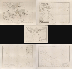
Carte des Atterrages de Singapore. / Carte Particulière des détroits de Singapore, Durian et Rhio. / Carte des Détroits de Singapore, Durian et Rhio et des Parages Environnants. / Carte du Détroit del Malacca Partie Septentrionale. / Carte du Détroit de Malacca Partie Méridionale.
$22,000.00
Acquire
- Digital Map Information
- Suitable for large format printing
- Full resolution TIFF file
- ICC color profile embedded
- Delivered instantly via download link
An exceptional set of five rare 1840s nautical maps/charts detailing Singapore, Malaya, and the Straits of Malacca and Singapore compiled by Urban Dortet de Tessan for the French Dépôt-Général de la Marine. The charts correspond to the Lagrené Mission, a French attempt to establish a colonial presence in East and Southeast Asia that challenged British regional hegemony. (more details)