
Wegener, Karl Friedrich Wilhelm Georg

Karl Friedrich Wilhelm Georg Wegener (May 31, 1863 – July 8, 1939) was a German geographer and explorer. He wrote a dissertation at the University of Marburg dealing with the orography of the Kunlun Mountains in China and took a teaching position at the Handelshochschule Berlin. He travelled throughout the world and wrote more than twenty books in addition to producing maps and atlases, making him one of the most prolific and prominent German geographers of his time. Late in his career, he led an effort to use airships for Polar exploration.
Mao consolidates his base before the Long March.
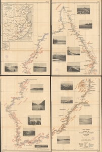
Aufnahmen am Fu-Kiang und Kan-Kiang in der Provinz Kaing-Si.
$1,300.00
Acquire
- Digital Map Information
- Suitable for large format printing
- Full resolution TIFF file
- ICC color profile embedded
- Delivered instantly via download link
This is an intriguing four-part map of Jiangxi Province, China, by the German geographer Georg Wegener. When this map was issued, the mountains around Jiangxi were the base where Mao and the People's Liberation Army consolidated before moving on to the rest of China. The map focuses on the Gan River (贛江 Ganjiang, or, as in the title, Kan-Kiang) and its tributaries, which flow into Poyang Lake (鄱陽湖) and the Yangtze River near Nanchang. (more details)