
Arrivet, J.

J. Arrivet (fl. c. 1737 - 1780) was a French engraver/ etcher active in Paris in the late 18th century. He produced work for Robert de Vaugondy, Bellin, Bonne, Lattre, and others. It is possible that he was the same 'Arrivet' who engraved the content for the 1737 Hydrographie Française. He never signed his first name, or initial, but Bénézit assigned to him the first initial 'J', almost certainly Jacques or Jean. He is not the engraver Pierre-Nicolas Arrivet (1766 -????), but may be a relation.
Elegant map of England.
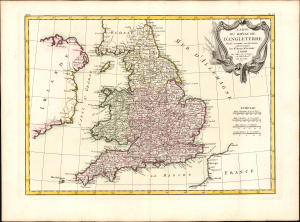
Carte du Royaume D'Angleterre.
$300.00
Acquire
- Digital Map Information
- Suitable for large format printing
- DPI: 600
- File Size: 11.97 MB
- File Type: ZIP / TIFF
- ICC color profile embedded
- Delivered instantly via download link
This is a beautiful, bright example of Rigobert Bonne's 1771 map of England and Wales. (more details)
Elegant 18th-century map of Ireland.
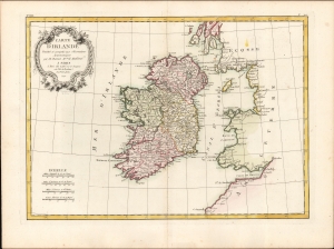
Carte D'Irlande Projettée de assujettie aux Observation Astronomiques par M. Bonne M.tre de Mathémat.
$350.00
Acquire
- Digital Map Information
- Suitable for large format printing
- DPI: 600
- File Size: 26.49 MB
- File Type: ZIP / TIFF
- ICC color profile embedded
- Delivered instantly via download link
A beautiful example of Rigobert Bonne's 1771 map of Ireland. (more details)
Detailed, Attractive map of Scotland.
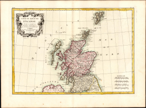
Carte du Royaume D'Ecosse.
$275.00
Acquire
- Digital Map Information
- Suitable for large format printing
- DPI: 600
- File Size: 10.97 MB
- File Type: ZIP / TIFF
- ICC color profile embedded
- Delivered instantly via download link
This is a beautiful, bright example of Rigobert Bonne's 1771 map of Scotland. (more details)
Spectacularly presented.
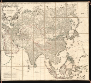
L'Asie divisée en ses Empires et Royaumes.
$3,500.00
Acquire
- Digital Map Information
- Suitable for large format printing
- Full resolution TIFF file
- ICC color profile embedded
- Delivered instantly via download link
A spectacularly presented c. 1787 Charles-François Delamarche / Robert de Vaugondy map of Asia. The beautifully presented map is laid down on unusual patterned linen and set into a fine royal blue slipcase with gold gilt tooling. (more details)
After the Revolution.
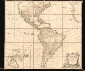
L'Amérique Septentrionale et Méridionale divisée suivant ses différens pays.
$4,500.00
Acquire
- Digital Map Information
- Suitable for large format printing
- Full resolution TIFF file
- ICC color profile embedded
- Delivered instantly via download link
A spectacularly presented c. 1787 Charles-François Delamarche / Robert de Vaugondy map of America. The map reflects the ephemeral political comportment of North America shortly after the American Revolutionary War (1775 - 1783). In South America, it illustrates the complex balance of territories, missions, and indigenous cultures that, within a decade, would give way to an extended period of conflict, wars of liberation, and civil strife. The beautifully presented map is laid down on unusual patterned linen and set into a fine royal blue slipcase with gold gilt tooling. (more details)