
Anse, Luggert Van

Luggert van Anse (fl. 1677-1716) was a Dutch map engraver, who worked in the shops of Visscher, van Keulen, and Pieter Husson. He appears to have been prolific, but as is often the case with Dutch engravers employed by larger printers or publishers, he would have been considered more of a workman than an artist, and consequently his education and early life are poorly documented.
Bold, detailed rarity of Spain and Portugal.
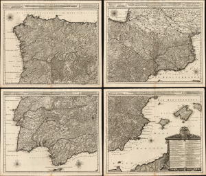
Novissima, et Accuratissima Tabula, qua Gallaeciae et Legionis Regna, Asturiarum Principatus. Portugalliae Tractus Septentrionalis et Utriusque Castellae, Extremadurae et Biscajae Partes./ ... Regnorum Arragoniae et Navarre, Principatus Cataloniae, nec non Partium con Conterminarum, Biscajae Utriusque Castellae ac Valentiae./ ... Regnorum Vandalitiae, Granatae, et Algarbiae; Tractuum, Meridionalium Portugalliae Extremadurae ac Castellae Novae./... Regnorum Valentiae et Murciae, Insularum Majorcae, Minorcae, et Ivicae qua etiam Vicinorum Regnorum Finitime Partes.
$8,500.00
Acquire
- Digital Map Information
- Suitable for large format printing
- Full resolution TIFF file
- ICC color profile embedded
- Delivered instantly via download link
This is a superb, rare example of Joachim Ottens' large, beautifully engraved c. 1719 four-sheet map of Spain and Portugal that notably references battles during the War of the Spanish Succession (1701 - 1714). The map was printed to four sheets for inclusion in folio atlases, but could be joined together to make a wall map. The plates had a convoluted, yet narrow publication history; any state of this map is a rare find. (more details)
Superb chart of the Pas de Calais and the mouth of the Thames.
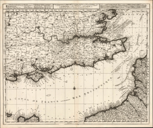
La Plus Grande Partie de la Manche: qui contient Les Côtes De Angleterre...
$1,100.00
Acquire
- Digital Map Information
- Suitable for large format printing
- Full resolution TIFF file
- ICC color profile embedded
- Delivered instantly via download link
This is Luggert van Anse's c. 1690 map of the English Channel, southeastern England, and the Pas-de-Calais. It was subsequently published by Renier and Josue Ottens in about 1730, whose imprint appears on this example. This is a superb work, combining granular inland detail with what had been state-of-the-art nautical charting of both the Channel and the mouth of the Thames River. This combination of detailed charting and inland mapping is unusual in maps of this period. (more details)
Celebrating the Glorious Revolution.
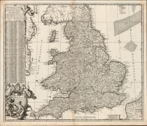
Regni Angliae Nova Tabula, Exhibens Principatum Walliae et aliarum Provinciarum, Civitatum, Oppidorum, una cum itineribus ab uno in aliam civitatem.
$550.00
Acquire
- Digital Map Information
- Suitable for large format printing
- Full resolution TIFF file
- ICC color profile embedded
- Delivered instantly via download link
This is Johannes de Ram's c. 1689 map of the kingdom of England. The present example is the third state, published c. 1730 by Renier and Josue Ottens, whose imprint appears at bottom-center. The map was published in the wake of the Glorious Revolution (1688 - 1689), the deposition of King James II, and his replacement by Mary II and William III of Orange. This Dutch-produced map celebrates the Revolution as a Dutch triumph; nonetheless, the extensive English text suggests it was intended for a British audience. (more details)