
Barker, Curtis Mason

Curtis Mason Barker (April 12, 1861 - August 4, 1908) was an American civil engineer and surveyor. Born in Detroit Michigan, Barker was the third of three children. His father, Kirkland Charles Barker (September 8, 1819 - May 20, 1875) was a successful businessman in Detroit who owned the American Eagle Tobacco Works there. He also served as mayor of Detroit from 1865 - 1867. Curtis Barker was educated at the Michigan State University at Ann Arbor (today known as the University of Michigan), where he studied civil engineering and surveying. After graduating, firm in the belief that his job prospects were better further west, Barker moved to Colorado where he worked in the mines and as a surveyor for railroads. He moved to California in 1885, and lived and worked in Palo Also as an assistant civil engineer on the construction of Leland Stanford University. He then moved to San Jose in 1894 and opened his own surveying and civil engineering firm. Soon after moving to San Jose he was appointed city engineer and held the position until July 1, 1902. He died on August 4, 1908, when he drowned in Halfmoon Bay along the California coast while yachting. It is unclear if his death was an accident. Curiously, his father drowned while yachting on the Detroit River when Barker was a child. Barker married Zoe A. Campbell in 1883, with whom he had two daughters.
San Jose at the Start of the 20th Century.
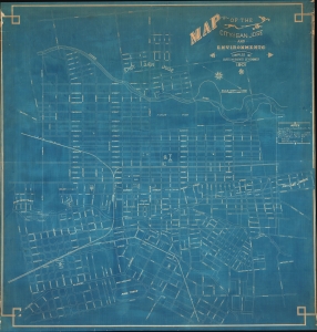
Map of the City of San Jose and Environments.
$4,500.00
Acquire
- Digital Map Information
- Suitable for large format printing
- File Size: 150.12 MB
- File Type: ZIP / TIFF
- ICC color profile embedded
- Delivered instantly via download link
This is the only surviving example of Curtis M. Barker's unrecorded 1901 cyanotype or blueprint city planning wall map of San Jose, California - today's 'Capital of Silicon Valley'. It presents the city during an explosive period of expansion, as new developments and neighborhoods were being added continuously. Given the size and precision of this map, it can only be an official city planning map used by the administration for urban management. (more details)
Origins of Los Altos.

Map of the Corita Vineyard. Being Lots 3 and 4 of the Briones Partition of the La Purissima Conception Chanco. The Property of A. B. Blanco.
$1,800.00
Acquire
- Digital Map Information
- Suitable for large format printing
- Full resolution TIFF file
- ICC color profile embedded
- Delivered instantly via download link
This is a c. 1912 Curtis M. Barker large-format map of the Foothills Preserve and Foothills Park in today's Los Altos and Los Altos Hills, California, in the heart of Silicon Valley. It is a window into the early development of the area, from land grants to viticulture and housing. (more details)