
Blanchard, Rufus
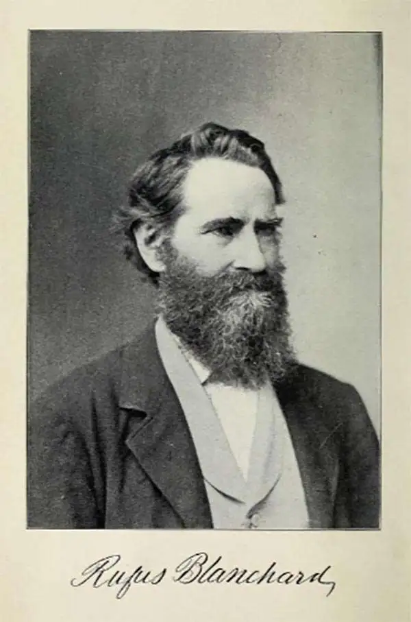
Rufus Blanchard Evanston (March 7, 1821 - January 3, 1904) was an American photographer, mapmaker, publisher, viewmaker, bookseller, and publisher active in Chicago in the second half of the 19th century. Blanchard was born in Lyndeborough, New Hampshire. He studied at Ipswich Academy, where he showed proficiency in Latin and Mathematics. He moved to New York in 1835 to live with his brother, Calvin Blanchard, who ran a bookstore at 78 Nassau St. He witnessed both the New York Fire of 1835 and the Wall Street bank panic of 1836. Perhaps believing civilization was doomed, he moved to the backwoods of Ohio, where he spent three years bushwhacking, hunting, and trapping. Returning to New York in 1840, Blanchard worked for the Harper Brothers publishing house. The publishing business suited Blanchard, leading to his relocation to Lowell, Massachusetts in 1843 to open a bookshop. This business lasted just 3 years before the restless young man moved again, this time to Cincinnati, where he opened another shop with his brother Edwin Blanchard. After some success, he established an annex office in New Orleans. The Cholera epidemic of 1847-1848, followed by the great fire of St. Louis, unfortunately, devastated his interests in the region. He moved back to New York in 1849, briefly establishing a printing concern with Charles Morse, son of the famous inventor, and working with the J. H. Colton firm. He relocated to Chicago sometime before 1853, when he established himself there as a printer and publisher. He relocated his business to the railroad hub of Chicago (52 LaSalle Street) in 1854 to capitalize on the national need for good railroad maps. In 1857, he published Chicago's first street guide. In addition to his Chicago business, he also had an office in Wheaton, Illinois. His nephew, George Cram (1842 - 1928), joined his business in 1867, after being discharged from the Union Army, and they rebranded as 'Blanchard and Cram.' Both 'Blanchard and Cram' of Chicago and the Wheaton businesses were destroyed in 1871 - the main business by the Great Chicago Fire, and the Wheaton office in a smaller fire. Nonetheless, Blanchard persevered and rebuilt both enterprises, though without Cram, who established his own firm, the George F. Cram and Company. In 1885, fire again destroyed his business, and he lost much of his map stock, but he persevered and rebuilt. Blanchard's personal life mirrored the highs and lows of his business life. He first married Permilla Far (1829 - 1857) in 1856. On their honeymoon, Permilla was severely injured and died shortly thereafter, in 1857, from related complications. He remarried in 1858 to Anna E. Hall (1842 - 1925). Blanchard lived to 83, and during the entire time, continued to actively photograph, write, and publish. It is said that he 'never grew old in heart or brain.'
Snapshot of a rapidly changing country.
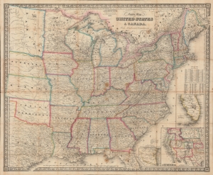
G. Woolworth Colton's New Guide Map of the United States and Canada, with Railroads, Counties etc.
$950.00
Acquire
- Digital Map Information
- Suitable for large format printing
- File Size: 1436.73 MB
- File Type: ZIP / TIFF
- ICC color profile embedded
- Delivered instantly via download link
An impressive 1862 folding map of the United States by George Woolworth Colton, heir of the prominent map publishing firm founded by his father Joseph Hutchins Colton. Remarkably detailed, it highlights railroads, state / territory and county lines, and demographic data at the height of the American Civil War (1861 - 1865). (more details)
Reconsidering Chicago's streets.

Blanchard's map of Chicago with new street names, steam railroads, street car lines, street numbers and sections.
$750.00
Acquire
- Digital Map Information
- Suitable for large format printing
- Full resolution TIFF file
- ICC color profile embedded
- Delivered instantly via download link
This is a large 1909 folding map of Chicago issued under the Rufus Blanchard imprint, with a supplementary diagram copyrighted by George F. Cram. Published as Chicago introduced its modern house-numbering system, it captures a metropolis working to bring order to decades of rapid expansion. An extensive network of railroads, elevated trains, and streetcar lines links the city's neighborhoods, passenger terminals, industrial districts, and the Union Stock Yards. (more details)