
Bongars, Jacques

Jacques Bongars (1554 - July 29, 1612) was a French scholar and diplomat. Born in Orléans nand raised as a Huguenot, he would receive most of his early education in Germany before returning to Orléans and Bourges. He joined the service of Ségur Pardaillan, a courtier to Henry, king of Navarre (later Henry IV of France.) Pardaillan sent him in 1587 on a mission to northern Europe, and later England to obtain help from Queen Elizabeth for Henry of Navarre. He continued to travel on behalf of Henry, and to the detriment of the house of Habsburg. His service continued until the king's murder in 1610. He died in Paris not long after. Bongars produced several books, including Gesta Dei per Francos, a collection of early works pertaining to the Crusades, with a particular focus on French participation in them.
Earliest acquirable medieval plan of Jerusalem.
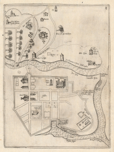
[Jerusalem.]
$2,000.00
Acquire
- Digital Map Information
- Suitable for large format printing
- Full resolution TIFF file
- ICC color profile embedded
- Delivered instantly via download link
This rare plan of Jerusalem is the earliest printed iteration of Pietro Vesconte's manuscript plan of the city. While not committed to print until this 1611 edition by Jacques Bongars, the map is the work of the 14th-century Venetian cartographer Vesconte, who produced it c. 1320 to promote Marino Sanudo's proposed crusade to recapture the city. As such, it is one of the earliest surviving plans to support a specific military effort. (more details)
Earliest printing of a Military Portolan of the Eastern Mediterranean.
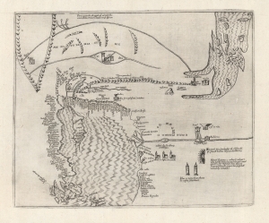
[Holy Land, Eastern Mediterranean, Egypt, Arabia and Mesopotamia.]
sold
- Digital Map Information
- Suitable for large format printing
- Full resolution TIFF file
- ICC color profile embedded
- Delivered instantly via download link
This is the earliest printed iteration of Pietro Vesconte's 1611 portolan map of the Eastern Mediterranean, the Lower Nile, the Arabian Peninsula, and Mesopotamia. While not committed to print until this 1611 edition by Jacques Bongars, the map is the work of the 14th-century Venetian cartographer Vesconte, who produced it c. 1320 to promote Marino Sanudo's proposed crusade. As such, it is one of the earliest surviving maps to support a specific military effort. (more details)