
Bourdin, Ernest

Ernest Bourdin (18?? - 18??) was a French publisher and printer active in the middle to late 19th century. His offices were located at 51 Rue e la Seine, Paris. Bourdin was a great supporter of the Mollweide / Babinet Projection and published an atlas using the system. His earliest publications date to the 1830s, with his latest work being in the late 1860s.
First printed example of a Babinet / Mollweide Projection.
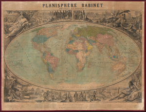
Planisphère Babinet Physique et Politique.
$3,500.00
Acquire
- Digital Map Information
- Suitable for large format printing
- File Size: 150.01 MB
- File Type: ZIP / TIFF
- ICC color profile embedded
- Delivered instantly via download link
A stunning c. 1860 wall-sized map of the world on a Mollweide or Babinet Projection surrounded by elaborate allegorical imagery. Our research suggests this is one of the earliest, if not the earliest, published examples of a Mollweide Projection. (more details)