
Brohier, John

John Brohier (fl. 1746 - 1760) was a British sailor, artilleryman, engineer, fraud, and fugitive from justice. The earliest record of Brohier is a 1746 manuscript chart of the harbor of Ambodifotatra on the island of Île Sainte-Marie, Madagascar. The chart references the anchorages used by the ship Winchelsea; this was most likely the Indiaman Winchelsea, which sailed for the EIC from 1742 until its wreck in April 1749 near Fort St. David (Bombay.) Apart from this chart, the name John Brohier first appears in East India Company dispatches - also, from Fort St. David - as a mariner, being permitted to reside in India beginning in January 1750. The next appearance of John Brohier is a request for appointment of a Lieutenant John Brohier, artilleryman, as assistant to Benjamin Robins, the Engineer General of the East India Company. No sooner was this request tendered than Robins died, and Brohier was appointed to carry out Robins' work on Fort St. George. From his death-bed, Robins had advised the Council, 'The Works here will be finished by Mr. Brohier, who has full instructions from me… He is certainly the properest Person for that Work I know and I recommend him as such. He has hitherto behaved, I believe, with great integrity.' Brohier went on to become Engineer-in-charge of all British territory in India, successfully improving the defenses of Fort St. David, Fort William, and Fort St. George over the course of the 1750s. In 1760, authorities in Calcutta reported that 'great Frauds (had been committed) in carrying out the new Works…' Brohier stood accused of having diverted a large amount of the funds allotted to the construction into his pockets. Arrested but then paroled, Brohier fled from Calcutta to Sri Lanka, which at the time was Dutch territory. It is supposed that he settled there, as he vanishes from the record.
Indian Ocean Pirate Utopia.
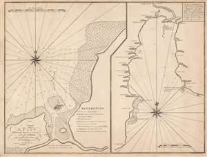
A Plan of the Principal Harbour and Town, of the Isl. S. Maries, Laying off the East Coast of the Isl. Madagascar in Lat. 17o. 00'S./ The Bay of Antongall on the N.E. part of the Island Madagascar.
$1,300.00
Acquire
- Digital Map Information
- Suitable for large format printing
- DPI: 600
- File Size: 45.88 MB
- File Type: ZIP / TIFF
- ICC color profile embedded
- Delivered instantly via download link
This is William Herbert’s rare 1767 chart illustrating Madagascar's most important northeast harbors: Ambodifotatra on Île Sainte-Marie, and Antongil Bay. Shortly before this chart was drawn, Île Sainte-Marie, was the site of the most famous and successful pirate utopia, and where Captain James Kidd's legendary galleon, the Adventure was scuttled. (more details)