
Brown, Flavius A.

Flavius A. Brown (August 31, 1806 - February 13, 1880) was an educator, politician, and publisher based in Hartford, Connecticut. Born in Hebron, Connecticut, Brown became renowned at a young age for his penmanship and by age 16 had become a teacher. After helping to construct a new schoolhouse in Hartford, which came to bear his name, Brown served as the chairman of the city's First School District for many years afterwards. He took on other roles in the community, including as secretary of the Hartford County Agricultural Society, and in business, serving as the director of several banks and insurance companies. He was elected Treasurer of Hartford in 1857. His career in publishing began with a business partnership with buying out the H.F. Sumner and Company bookstore in 1834, renamed Packard and Brown, and in 1837 renamed again to Brown and Parsons (Edward W. Parsons). Parsons retired in 1852 and Brown took on one W. Gross as a partner until he stepped back to focus on other pursuits from 1858. Still, the name Brown and Gross continued to be used and it remained a prominent publisher into the late 19th century.
Early railroads of New England.
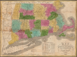
Map of Massachusetts Connecticut and Rhode Island constructed from the latest authorities.
$800.00
Acquire
- Digital Map Information
- Suitable for large format printing
- Full resolution TIFF file
- ICC color profile embedded
- Delivered instantly via download link
A hand-colored 1838 pocket map of Massachusetts, Connecticut, and Rhode Island, published by Flavius Brown and Edward Parsons. It captures the region in the early days of the railroad boom, when both canals and railroads were being proposed and built at a frenetic pace. (more details)
Settling the great northern wilderness.
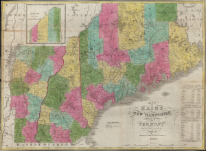
Map of Maine New Hampshire and Vermont, From the most authentic Sources.
$950.00
Acquire
- Digital Map Information
- Suitable for large format printing
- Full resolution TIFF file
- ICC color profile embedded
- Delivered instantly via download link
This is a 1847 pocket map of Maine, New Hampshire, and Vermont published by Brown and Parsons. It illustrates the demographic, territorial, and infrastructural development of the states since the founding of the United States. (more details)