
Canu, Jean Dominique Etienne

Jean Dominique Etienne Canu (1768 - 1843) was a French engraver active in Paris from about 1780 to 1816. Canu's work mostly focused on fashion plates, portraiture, architecture, and natural history. Canu studied under Delaunay, another French engraver. Little is known of his life and the date of his death remains obscure. His cartographic corpus is minimal.
First printed map of Tonkin
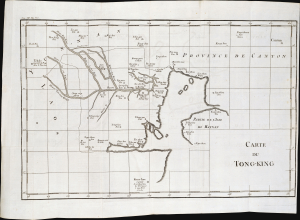
Carte du Tong-King.
$850.00
Acquire
- Digital Map Information
- Suitable for large format printing
- File Size: 7.99 MB
- File Type: ZIP / TIFF
- ICC color profile embedded
- Delivered instantly via download link
This is the first printed map specifically of northern Tonkin, drawn by Jean Dominique Etienne Canu in 1781. Based on Jesuit reports, the map depicts the territory and cities of the northern parts of the Đàng Ngoài. These feudal lords ruled the deltas of the Red River, the Mã River, and the Cả River. (more details)
An early map of the Red River in Vietnam based on Jesuit reports.
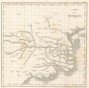
Carte du Tunquin.
$500.00
Acquire
- Digital Map Information
- Suitable for large format printing
- DPI: 600
- File Size: 11.69 MB
- File Type: ZIP / TIFF
- ICC color profile embedded
- Delivered instantly via download link
This is an extremely rare c. 1810 Porlier map of the Red River system in northern Vietnam and the Gulf of Tonkin. The map depicts part of northern Vietnam concentrated around the Red River system (Fleuve Fou Teang Kiang) and Tong-tou (most likely modern-day Hanoi), marked as the capital of Tonkin (Capitale du Tunquin). Numerous other towns and villages are labeled, as are several islands in the Red River delta and along the coastline. Parts of Ha Long Bay are also illustrated. (more details)