1810 Porlier Map of the Red River System and the Gulf of Tonkin, Vietnam
CarteTunquin-porlier-1810$500.00

Title
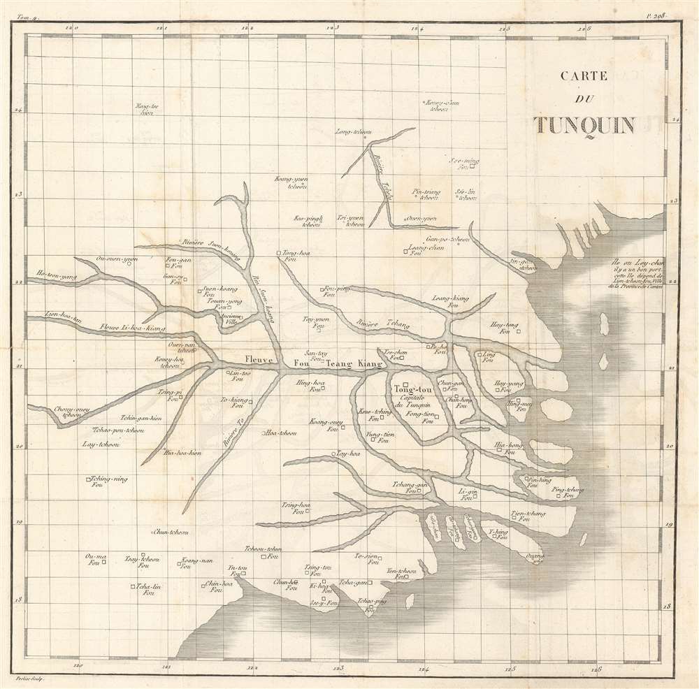
Carte du Tunquin.
1810 (undated) 14.5 x 14.5 in (36.83 x 36.83 cm)
1810 (undated) 14.5 x 14.5 in (36.83 x 36.83 cm)
Description
This is an extremely rare c. 1810 Porlier map of the Red River system in northern Vietnam and the Gulf of Tonkin. The map depicts part of northern Vietnam concentrated around the Red River system (Fleuve Fou Teang Kiang) and Tong-tou (most likely modern-day Hanoi), marked as the capital of Tonkin (Capitale du Tunquin). Numerous other towns and villages are labeled, as are several islands in the Red River delta and along the coastline. Parts of Ha Long Bay are also illustrated.
Census and Publication History
We know that a very similar earlier map was compiled from Jesuit sources by Jean Dominique Etienne Canu for publication in Yves Mathurin Marie Treaudet de Querboeuf's Lettres Edifiantes et Curieuses. We believe that this map was published in the 1810 edition of Lettres Edifiantes. We have not found any known examples in institutional collections or on the private market.Cartographer
Jean Dominique Etienne Canu (1768 - 1843) was a French engraver active in Paris from about 1780 to 1816. Canu's work mostly focused on fashion plates, portraiture, architecture, and natural history. Canu studied under Delaunay, another French engraver. Little is known of his life and the date of his death remains obscure. His cartographic corpus is minimal. More by this mapmaker...
Condition
Very good. Even overall toning. Verso repairs to fold separations. Light transference. Blank on verso.