
Chace Jr., Jacob

Jacob Chace Jr. (January 27, 1819 - February 18, 1903) was an American surveyor, civil engineer, educator, and map publisher. Born in North Hoosick, New York, Chace became one of the most prolific creators and publishers of county maps of the northeastern United States in the mid-19th century. He was involved in the production of large-format county maps, published mostly between 1854 and 1860. Many of these counties were in Maine, but he also produced maps of Vermont, New Hampshire, and New York. There is some ambiguity in historical accounts of his date of death. Many references state that he died in 1864 while Ambrose F. Church was working for him to create a map of Nova Scotia. However, references to a Jacob Chace surveying towns for maps of Virginia and North Carolina appear in newspaper columns in the 1870s and 1880s. Chace's name is sometimes misspelled on maps and references as 'Chase'. Our own research confirms that Chase died in Omaha, Nebraska, on February 18, 1903.
First large scale map of the state to be issued after the Greenleaf third edition of 1844. - Rumsey
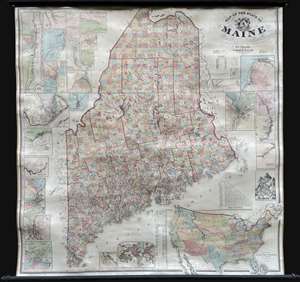
Map of the State of Maine.
$3,000.00
Acquire
- Digital Map Information
- Suitable for large format printing
- Full resolution TIFF file
- ICC color profile embedded
- Delivered instantly via download link
An impressive large-scale 1862 Civil War era wall map of Maine by Henry Francis Walling and Jacob Chace Jr. This the first major map of Maine to follow the 1844 map of Jeremiah Greenleaf. The map represents the culmination of Walling and Chace's decades of work in Maine. For years, they compiled and published Maine city and county maps, giving them access to unprecedented up-to-date cartographic data, all of which is represented here. (more details)