
Cowperthwait, Joseph Baker

Joseph Baker Cowperthwait (October 15, 1833 - November 26, 1891) was an American book and map publisher. Born in Philadelphia, Cowperthwait became a successful map publisher, taking over the Samuel Augustus Mitchell Sr. (1792 - 1868) maps, atlases, and plates in 1850. His father, Hulings Cowperthwait (1802 -1873), began the publishing business, and was part of a few publishing firms, including Thomas, Cowperthwait, and Company and Cowperthwait, Desilver, and Butler. Cowperthwait, Desilver, and Butler dissolved in 1855 and H. Cowperthwait, Joseph B. Cowperthwait, D. M. Warren, George Pancoast, and Theodore H. Butler together formed H. Cowperthwait and Co. Cowperthwait died on Thanksgiving Day, 1891.
A Pillar of the Antebellum South.
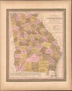
A New Map of Georgia with its Roads and Distances.
$250.00
Acquire
- Digital Map Information
- Suitable for large format printing
- DPI: 600
- File Size: 294.39 MB
- File Type: ZIP / TIFF
- ICC color profile embedded
- Delivered instantly via download link
This is S. A. Mitchell's 1850 map of Georgia, illustrating the state at its peak as a pillar of the antebellum South. (more details)
Key to the Mississippi.
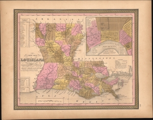
A New Map of Louisiana with its Canals, Roads and Distances from place to place, along the Stage and Steam Boat Routes.
$250.00
Acquire
- Digital Map Information
- Suitable for large format printing
- DPI: 600
- File Size: 299.01 MB
- File Type: ZIP / TIFF
- ICC color profile embedded
- Delivered instantly via download link
This is S. A. Mitchell's 1850 map of Louisiana and New Orleans. (more details)
Birth of Railroads in Northern New England.
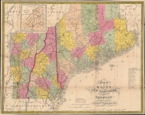
Map of Maine New Hampshire and Vermont compiled from the Latest Authorities. / Maine New Hampshire and Vermont.
$750.00
Acquire
- Digital Map Information
- Suitable for large format printing
- File Size: 23.18 MB
- File Type: ZIP / TIFF
- ICC color profile embedded
- Delivered instantly via download link
This is Samuel Augustus Mitchell's 1852 pocket map of Maine, New Hampshire, and Vermont, engraved by James Young. Among other features, it is especially important for illustrating the early development of railroad networks in these states. (more details)
Europe during the Crimean War.
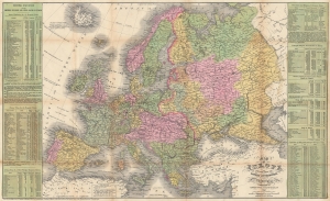
Map of Europe Compiled From the Latest Authorities.
$450.00
Acquire
- Digital Map Information
- Suitable for large format printing
- File Size: 34.39 MB
- File Type: ZIP / TIFF
- ICC color profile embedded
- Delivered instantly via download link
This is a separate issue 1854 Young and Cowperthwait map of Europe published during the Crimean War. Likely printed to capitalize on American interest in the war, Austrian gains in the Balkans in 'Servia' (Serbia) and Wallachia are outlined in red manuscript. (more details)