
Dicey, Cluer

Cluer Dicey (1714-1775) was an English printer, publisher and engraver. He was the son of printer, engraver and newspaperman William Dicey (1690-1756), from whom it appears he learned the trade. Cluer joined his father in the business and took charge after William's death. Among other works, he republished the county maps of Christopher Saxton, and produced the final 1770 edition of John Speed's atlas of England and Wales.
Marking the Momentous Battle of Bosworth.
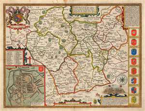
Leicester, both Countye and Citie described, the Honorabe Famylies that have had titles of Earls thereof. With other accidents therein observed.
$750.00
Acquire
- Digital Map Information
- Suitable for large format printing
- Full resolution TIFF file
- ICC color profile embedded
- Delivered instantly via download link
This is John Speed's 1770 map of the East Midlands county of Leicestershire, England. It was first included in Speed's county atlas and remained in publication long after Speed's death, and in this case this specific map was printed in Cluer Dicey's scarce, final edition of 1770. The map is richly detailed, showing towns, abbeys, castles, forests, and parklands. An inset plan in the lower left details the walled town of Leicester with a key naming thirty-four streets, gates and buildings. Along the right side of the map are displayed the armorial crests of eight of the historical Earls of Leicester. At the bottom are the arms of Robert Sidney, the second Earl of Leicester (probably added by Bassett and Chiswell in 1676). At the upper left are the Royal Arms, with the motto 'Dieu et Mon Droit.' (more details)