
Dodge, Jacob Richard

Jacob Richard Dodge (September 28, 1923 - c. 1890) was an American publisher, poet, and journalist. Born in New Boston, New Hampshire, Dodge learned the art of printing in the offices of the Amherst Cabinet, a local newspaper. After graduating from school he accepted a post as a schoolmaster in Mississippi, where he remained for five years, before returning to Nashua, New Hampshire. During this period in Nashua he published his only map, a railroad guide and wall map of New Hampshire. In 1855 he moved to Ohio, where he published the American Ruralist, a regional agricultural newspaper. In 1861 Dodge again relocated, this time to Washington D. C. There he took a position as Senate Reporter for the National Intelligencer. From 1866 to 1878 he worked as Statistician for the Department of Agriculture. In this role he was sent to Europe to represent United States agriculture at the 1873 Vienna Exhibition. Dodge continued to work in statistics with the U.S. Government until the 1880s. It is unclear when Dodge died.
New Hampshire Railroad boom. Printed in Nashua!
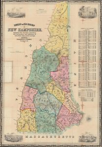
Township and Rail Road Map of New Hampshire, compiled from the best authorities with corrections and alternation of town lines from actual surveys.
$1,200.00
Acquire
- Digital Map Information
- Suitable for large format printing
- DPI: 600
- File Size: 988.93 MB
- File Type: ZIP / TIFF
- ICC color profile embedded
- Delivered instantly via download link
This is the 1854 first edition Jacob Richard Dodge map of New Hampshire, one of a few such maps published in New Hampshire. The map was issued to illustrate the growth of railroad networks throughout the state. Dodge emphasized railroad construction in the Merrimack River corridor, where the railroad fueled a textile boom in Nashua and Manchester. (more details)
Iron Rails across the Granite State.
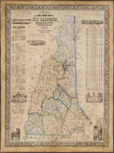
Township and Rail Road Map of New Hampshire.
$3,500.00
Acquire
- Digital Map Information
- Suitable for large format printing
- File Size: 4144.03 MB
- File Type: ZIP / TIFF
- ICC color profile embedded
- Delivered instantly via download link
This is Jacob Richard Dodge's 1860 wall map of New Hampshire, printed by L. H. Bradford. It provides a detailed overview of the state, highlighting its rail network and including statistics, geographical information, and vignette illustrations. (more details)