
Du Bois, Nicholas (N. Du Bois)

Nicholas Du Bois (January 25, 1823 - August 8, 1879) was an engineer and draughtsman in the Washington D.C. General Land Office. Du Bois was born in Great Bend, Pennsylvania. Little is known of his early education, but in the 1850 census, he appears as an 'engineer'. By 1862, he was a clerk at the General Land Office. Subsequent reports from 1864 name him a draughtsman. He drafted William Keeler's seminal 1867 National Map of the Territory of the United States from the Mississippi River to the Pacific Ocean. By 1873, he was listed as an 'Assistant Surveyor'. Du Bois died in Washington, D.C. in 1879.
AKA: N. Du Bois
Seminal map of the Trans-Mississippi, in a true 1st Edition 1st State.
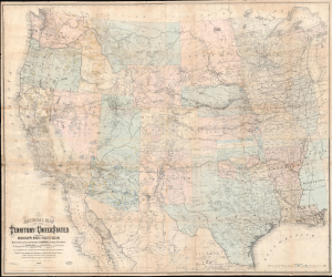
National Map of the Territory of the United States From The Mississippi River To The Pacific Ocean.
$6,500.00
Acquire
- Digital Map Information
- Suitable for large format printing
- Full resolution TIFF file
- ICC color profile embedded
- Delivered instantly via download link
An extraordinary first-edition first-state example of William J. Keeler's seminal 1867 map of the Trans-Mississippi West - considered the finest post-Civil War railroad era map of the West. This is the true first edition, without American Indian reservations, which were added in subsequent editions issued within the same year. (more details)
Seminal map of the Trans-Mississippi showing mineral deposits and the emergence of the American Indian Reservation System.
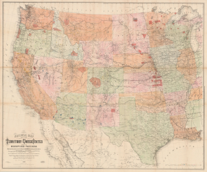
National Map of the Territory of the United States From The Mississippi River To The Pacific Ocean.
$6,500.00
Acquire
- Digital Map Information
- Suitable for large format printing
- File Size: 175.65 MB
- File Type: ZIP / TIFF
- ICC color profile embedded
- Delivered instantly via download link
An extraordinary first-edition third-state example of William J. Keeler's seminal 1867 map of the Trans-Mississippi West - considered the finest post-Civil War railroad era map of the West. The map is noteworthy for its meticulous mapping of mineral deposits and the often overlapping evolution of the American Indian Reservation System. Significantly, this is the finest example of this important map we have seen. Most examples of this map, because it was mounted on linen on a single sheet rather than dissected, typically exhibit significant wear and condition issues. The present example, likely opened only a few times in its long life, exhibits an exceptional state of preservation. (more details)