
du Halde, Jean-Baptiste (杜赫德)

Jean-Baptiste du Halde (杜赫德; February 1, 1674 – August 18, 1743) was a French Jesuit historian and geographer. Although he was not part of the Jesuits' China mission, he did collect letters, memoirs, and other information from the Jesuits in China to publish the work Geographical, Historical, Chronological, Political, and Physical Description of the Empire of China and Chinese Tartary in 1735, which had a significant influence throughout Europe for decades afterwards. Among those it inspired was Jean Baptiste Bourguignon d'Anville, who used du Halde's descriptions (based on a land survey under the Kangxi Emperor that the Jesuits were involved in) to draw his famous map of China, which was the gold standard in Europe into the 19th century.
AKA: 杜赫德
Seminal Map of the Beni, Boliva.
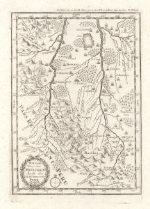
Mission bey den Moschen durch die IESUiter von Peru Gestifft.
$350.00
Acquire
- Digital Map Information
- Suitable for large format printing
- File Size: 2.53 MB
- File Type: ZIP / TIFF
- ICC color profile embedded
- Delivered instantly via download link
This is an influential c. 1726 map of the Beni in Bolivia and surrounding areas, which appeared in Joseph Stöcklein's Der Neue Weltbott. Based on a c. 1713 manuscript map, it is a critically important map in the cartography of this part of South America, serving as the basis for later maps of the region for years afterwards. (more details)