
Edmonds, Alfred M.

Alfred M. Edmonds (1821 - November 23, 1893) was a Canadian cartographer, draughtsman, and artist. Born in Bishopstone, England, it is unclear when Edmonds immigrated to Canada. He was a school teacher in Burnstown, Ontario in 1863, and also appeared in a directory as a draughtsman that year as well. He created a sketchbook for the Haycock Iron Mine in Cantley, Quebec, in 1872. He worked as a cartographer for the Canadian Pacific Railway and the Canada Department of Reailways and Canals from 1881 until his death. In 1884, Edmonds worked as an assistant to Sir Sandford Fleming, the head of the Canadian Intercontinental Railway. At the time of his death, on November 23, 1893, Edmonds was an inmate at a local jail. At the time of his arrest on February 27, 1893, Edmonds was described as 'a pale, delicate-looking man, who it is thought was insane'. The coroner, after the inquest into Edmonds's death concluded, stated, 'We wish...to expess our disapproval in the detention in jail of such a case...which was one for a charitable institution.'
Foundation of Canadian coast-to-coast sovereignty!
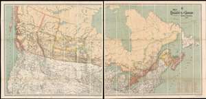
Map Shewing the Railways of Canada to Accompany Annual Report on Railway Statistics.
$7,500.00
Acquire
- Digital Map Information
- Suitable for large format printing
- Full resolution TIFF file
- ICC color profile embedded
- Delivered instantly via download link
The is the first official map of the Canadian Pacific Railroad issued after the railroad's completion in 1885. This map is of critical importance to the development of the Canadian Confederation, as well as the first complete map of the second North American intercontinental railroad. This enormous map was issued in 1886 by A. M. Edwards and Canadian Government Railways. Depicting the entire country in two sections, the map identifies ninety-three different railways throughout Canada - but the focus is the impressive Canadian Pacific Route, which stretches from Montreal to British Columbia. Maritime routes between North America and Europe and Asia, which connected to the Railroad and were part of the Canadian Pacific's marketing model, are also noted. (more details)