
Fatout, Charles

Charles Fatout (18?? - 1882) was a French engraver, bookseller, second-hand bookseller, map seller, print seller, bookbinder, and stationer active in Paris during the second half of the 19th century. From about 1840 he was based at Boulevard Poissonnière 17, an office he may have shared with other engravers and publishers of the period. In addition to his private work, he was also employed as a senior clerk under Damascène Morgand (1840 - 1898) in the second-hand book department of the Auguste Fontaine firm, Passage de Panoramas. In 1875, Morgand separated from Fontaine, and taking Fatout along, took over the bookshop of M. E. Caen, founding, 'Librairie Morgand et Fatout' at 55 Passage des Panoramas. Fatout is described in period literature as 'cold and calculating' leading to the success of his firm. Following Fatout's death in 1882, 'Morgand et Fatout' was formally dissolved, but the firm continued under 'Morgand' until 1897. At this time, himself ready to retire, Morgand sold the business at auction to Abbé Bossout, H. Destailleur, and Émile Müller.
Vignettes of Paris monuments!
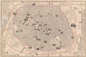
Nouveau Plan Illustré de la Ville de Paris avec le systéme complet de ses Fortifications et Forts Détaches.
$750.00
Acquire
- Digital Map Information
- Suitable for large format printing
- DPI: 600
- File Size: 58.51 MB
- File Type: ZIP / TIFF
- ICC color profile embedded
- Delivered instantly via download link
A beautiful 1847 illustrated pictorial map of Paris, France, by Charles Fatout. Centered on the Seine, this map covers embastilled Paris as contained by the Thiers Wall as well as its immediate vicinity, including the Bois de Boulogne and Bois de Vincennes. Gardens, monuments, and parks are illustrated either in profile or in the form of vignette engravings – making this an ideal companion for the curious tourist. Trains are delightfully drawn entering and leaving the city in four locations. (more details)
Vignettes of Paris monuments!

Nouveau Plan Illustré de la Ville de Paris avec le systéme complet de ses Fortifications et Forts Détaches.
$750.00
Acquire
- Digital Map Information
- Suitable for large format printing
- DPI: 600
- File Size: 147.56 MB
- File Type: ZIP / TIFF
- ICC color profile embedded
- Delivered instantly via download link
A beautiful 1847 illustrated pictorial map of Paris, France, by Charles Fatout. Centered on the Seine, this map depicts embastilled Paris as contained by the Thiers Wall as well as its immediate vicinity, including the Bois de Boulogne and Bois de Vincennes. Gardens, monuments, and parks are illustrated either in profile or in the form of vignette engravings – making this an ideal companion for the curious traveler. Trains are delightfully drawn entering and leaving the city in four locations. (more details)