
Fleurieu, Charles Pierre Claret, comte de
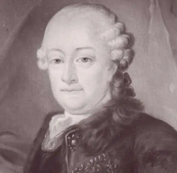
Charles Pierre Claret, Comte de Fleurieu (July 2, 1738 - August 18, 1810) was a French explorer, and hydrographer. He served in the French Navy from the age of 13, campaigned in the Seven Years' War, and quickly became regarded an officer of distinction and intelligence. By 1765 he was engaged under Ferdinand Berthoud in the French efforts to produce a marine chronometer, the great 18th century arms race against Britain to determine a method to calculate longitude at sea. He was in command of an expedition aboard the frigate Isisin order to test Berthoud's chronometers at sea between autumn 1768 and October 1769 (as well as to observe the transit of Venus of June 3, 1769). By 1776 Fleurieu had been named capitaine de vaisseau, and he was made director of ports and arsenals in 1777 by Louis XVI. He directed nearly all planning for French naval operations in the during the American Revolution, and all the French voyages of discovery during that period (including, for example, those of La Perouse). He continued to flourish under the Ancien Regime, but oddly his decades of loyal service seem to have been overlooked during the French Revolution which - as well as the Reign of Terror - he survived. He was able to return to service as a member of the Bureau des longitudes and became a member of the Institute de France, After the fall of Robespierre he was made a member of the Bureau des longitudes and of the Institut after M. de Bougainville's resignation in 1795. In 1797 (year V) he was elected deputy for the Seine in the Council of Ancients under the name Claret-Fleurieu. He remained so until the coup d'état of 18 Fructidor when he was excluded from the Council. He was elected a member of the Conseil d'État on 24 December 1799, and during the French First Empire he would become a successful politician until his sudden death in 1810.
First modern chart of the Azores.
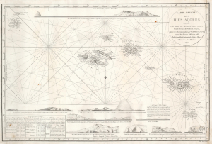
Carte Réduite des Îles Açores dressée Par Ordre du Ministre de la Marine Pour le Service des Vaisseux Français, d'après les Observations faites par M. de Fleurieu, en 1769 et par Don Vicente Tofiño en 1788. / Publiée au Dépôt général des Cartes, Plans et Journaux de la Marine. 1791.
$950.00
Acquire
- Digital Map Information
- Suitable for large format printing
- Full resolution TIFF file
- ICC color profile embedded
- Delivered instantly via download link
This elegant, separately-issued, Depot de la Marine nautical chart / map of the Azores is the first to employ modern nautical surveys using marine chronometers. This chart combines the data of the French hydrographer Charles Pierre Claret, Comte de Fleurieu (1738 - 1810), with that of the Spanish hydrographer Vincente Tofiño de San Miguel (1732 - 1795), whose respective surveys represented the first scientific charting of the Azores. It represents a vast improvement over the 1755 Bellin Carte Réduite des Îles Açores, which, until 1791, was the best French charting of the islands. (more details)