
Friend, Norman

Norman Friend (1814 - February 25, 1888) was a Danish-American lithographer and engraver, specializing in map work. Friend was born in Denmark and emigrated to the United States in 1844, settling in Philadelphia. He was certainly a citizen by 1851, at which point he served as the citizenship sponsor to Jacob Aub, with whom he partnered in the firm of Friend and Aub. After Aub's departure to the military in 1861, Friend continued to operate at the address under his own name until his death. Friend and Aub executed maps for many publishers, including Walling, McIntyre, Bridges, Smith, and Otley.
On the cover of Ristow's 'Maps and Mapmakers.'
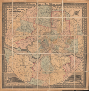
Map of the Circuit of Ten Miles Around the City of Philadelphia With the names of Villages, Roads, Milles, Property Owner, Taverns, etc. / Sidney's Map of Ten Miles round.
$3,800.00
Acquire
- Digital Map Information
- Suitable for large format printing
- File Size: 35.64 MB
- File Type: ZIP / TIFF
- ICC color profile embedded
- Delivered instantly via download link
This is an attractive example of J. C. Sidney's 1847 map of Philadelphia, covering the city and its vicinity 'Ten Miles round'. Smith, the publisher, considered this one of the 'most successful of his maps'. Water Ristow, in American Maps and Mapmakers, placed this map on the cover, devoted a full-page illustration to it, and included several pages of text, underscoring its significance as an example of mid-19th-century American map publishing. Indeed, its producers were a who's who of Philadelphia map publishing: Robert Persall Smith, Norman Friend, Augustus Köllner, Peter Steven Duval, and James Charles Sidney. (more details)
Newburyport at its height as a Maritime Center.
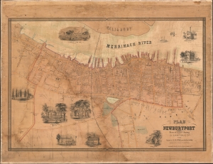
Plan of Newburyport, Mass. From an actual Survey by H. McIntyre C.E. 1851.
$2,000.00
Acquire
- Digital Map Information
- Suitable for large format printing
- DPI: 600
- File Size: 84.31 MB
- File Type: ZIP / TIFF
- ICC color profile embedded
- Delivered instantly via download link
A rare 1851 map of Newburyport, Massachusetts, produced by surveyor Henry McIntyre. The map captures Newburyport at the height of its prominence as a maritime center. This is a very scarce work by a local mapmaker. (more details)