
Geological Survey of Japan (全國地質測量)

Geological Survey of Japan (全國地質測量; 1878 - present) was originally an office within the Japanese government's Ministry of Home Affairs (内務省) and later other government ministries before becoming an independent organization (地質調査総合センター) in 2001. It its early years, it played an important role developing Japan's energy resources during the crash course of modernization during the Meiji era. It focused in particular on resource-rich Hokkaido (then known as Ezo, a term referring to Japan's entire northern frontier) and was closely affiliated with the Hokkaidō Development Commission (開拓使, Kaitakushi).
AKA: 全國地質測量
Mapping Japan's Minerals.
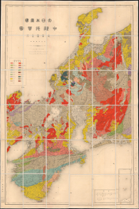
大日本帝國中部地質圖 / [Geological Map of the Central Part of the Empire of Japan].
$1,500.00
Acquire
- Digital Map Information
- Suitable for large format printing
- File Size: 88.61 MB
- File Type: ZIP / TIFF
- ICC color profile embedded
- Delivered instantly via download link
This is a large-format folding geological map of Central Japan, prepared in 1914 by the Geological Survey of Japan, then part of the Nōshōmushō, Japan's Ministry of Agriculture and Commerce. (more details)