
Greenwood, Christopher

Christopher Greenwood (May 21, 1786 - March 25, 1825) was a British surveyor and mapmaker active in Wakefield and London in the early 19th century. He was born in Gisburn, Yorkshire. He lived and worked in Wakefield until 1818, when he moved to London. He partnered with George Pringle and Pringle's son George, to publish maps. This partnership lasted until 1828, when it was dissolved. Pringle was imprisoned for debt in 1834 and his map plates sold at auction in 1840. He worked extensively with his brother John Greenwood (1791 - 1867) and the engraver Samuel John Neele. He is best known for his enormous 1827 wall map of London.
Grandest Cartographic Representation of Regency London.
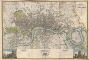
Map of London, from An Actual Survey made in the Years 1824, 1824 and 1826 by C. an J. Greenwood.
$15,000.00
Acquire
- Digital Map Information
- Suitable for large format printing
- Full resolution TIFF file
- ICC color profile embedded
- Delivered instantly via download link
This is the rare first edition of Christopher and John Greenwood's large-scale 1827 map of London, produced at the height of the Regency period, during which the city was being crafted into a neoclassical metropolis, driven by the Prince Regent (George IV) himself but realized by his favored architect, John Nash. Greenwood's map, in its grand presentation and monumental scope, is the essential cartographic expression of the Regency, and it is considered the largest and finest plan of London to appear in the 19th century. (more details)