This item has been sold, but you can get on the Waitlist to be notified if another example becomes available, or purchase a digital scan.
1827 First Edition Greenwood Map of London, England
London-greenwood-1827$14,750.00

Title
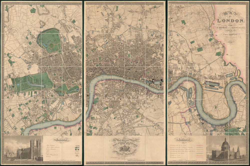
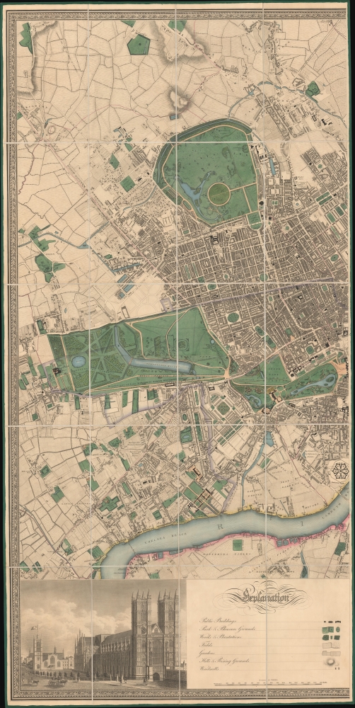
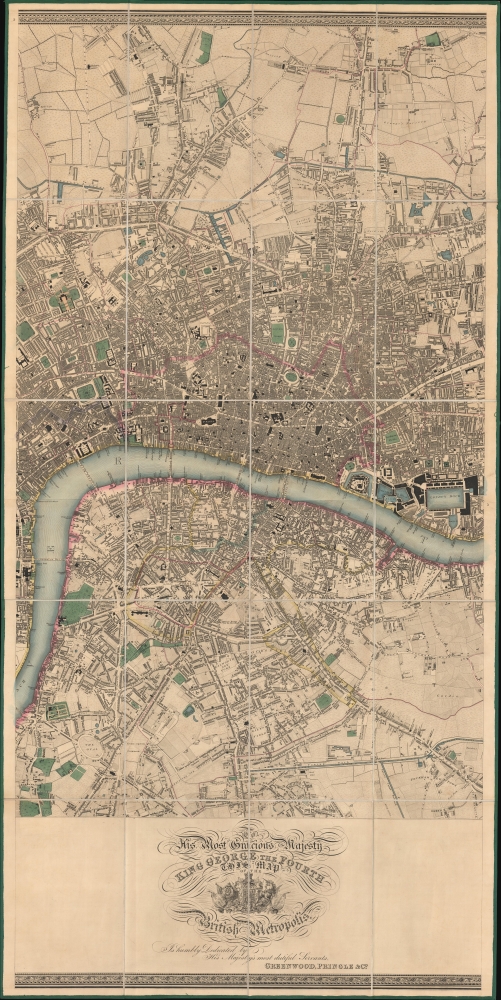
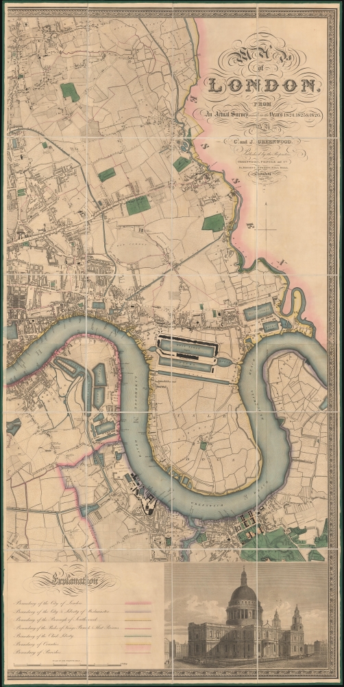
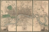
Map of London, from An Actual Survey made in the Years 1824, 1824 and 1826 by C. an J. Greenwood.
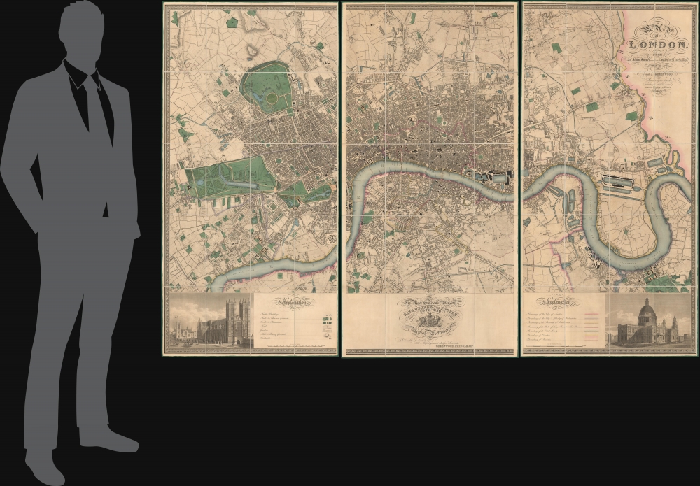
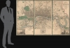
1827 (dated) 50 x 75 in (127 x 190.5 cm) 1 : 7920
1827 (dated) 50 x 75 in (127 x 190.5 cm) 1 : 7920
Description
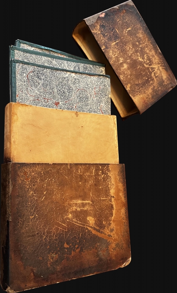
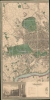
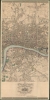
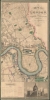
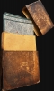
This is the rare first edition of Christopher and John Greenwood's large-scale 1827 map of London, here in a spectacularly preserved example. It is considered the largest and finest plan of London to appear in the 19th century. The present example is presented in three linen-backed folding sections, and is accompanied by its original leather slipcase.
A Closer Look
This map is the result of a 3-year long survey effort by brothers Christopher and John Greenwood. Coverage extends from Kentish Town in the north, to the River Lea, Greenwich, and Kensington. Vignette images in the lower corners illustrates Westminster Abbey and St. Paul's Cathedral. The map captures Thomas Cubitt's development of Belgravia, outlines new roads in Bayswater, follows the 1826 completion of the Grand Surrey Canal, and maps Regent's Park as it was being developed. The Greenwood map was not superseded for detail and accuracy until the emergence of the Ordnance Survey in the mid-19th century.Publication History and Census
This map was engraved in six plates for Greenwood, Pringle and Company in 1827 by James and Josiah Neele. The first edition can be distinguished by the dedication to King George being located at bottom center - in later editions it was moved to the upper right.CartographerS
Christopher Greenwood (May 21, 1786 - March 25, 1825) was a British surveyor and mapmaker active in Wakefield and London in the early 19th century. He was born in Gisburn, Yorkshire. He lived and worked in Wakefield until 1818, when he moved to London. He partnered with George Pringle and Pringle's son George, to publish maps. This partnership lasted until 1828, when it was dissolved. Pringle was imprisoned for debt in 1834 and his map plates sold at auction in 1840. He worked extensively with his brother John Greenwood (1791 - 1867) and the engraver Samuel John Neele. He is best known for his enormous 1827 wall map of London. More by this mapmaker...
John Greenwood (March 25, 1791 - October 1, 1867) was a British surveyor, mapmaker, and publisher active in London in the early to mid-19th century. John was the younger brother of fellow mapmaker, Christopher Greenwood (1786 - 1825). He was born in Gisburn, Yorkshire. He worked for a time in London with his brother John, and George Kemp in a surveying partnership. The Kemp partnership was dissolved in 1827, curiously around the same time the Greenwood brothers issued their monumental plan of London. Learn More...
Josiah Neele (March 30, 1804 - March 22, 1876) was a British map engraver, printer, and publisher active in London during the middle part of the 19th century. Neele was the son of Samuel John Neele (1758 - 1824), also a prominent map engraver. He apprenticed under his father along with Ebenezer Stalker (1780 - 1847) with whom he briefly partnered until 1825. At that time, he went into business with his uncle, George Neele, and his brother, James Neele. George retired in 1826, ending that partnership, after which the brothers published until 1929 under the imprint of 'James and Josiah Neele'. Josiah subsequently continued the business under his own name, operating from their former offices at 352 Strand, until 1836, when he declared bankruptcy. In 1845 he married Eliza Atwood of Haverfordwest and in the wedding documents he is described as a stationer. He retired to Wiltshire in 1871 and died five years later in 1876. Learn More...
Condition
Pristine. Original color. Original linen backing. Original slipcase.
References
Howgego, James L., Printed Maps of London circa 1553-1850, #309. Rumsey 10241.001.