
Haussard, Élisabeth

Élisabeth Haussard (1700-1804) was a French scientific illustrator and engraver/etcher. She was thee youngest daughter of engraver Jean-Baptiste Haussard. She participated in the family trade, engraving illustrations for scientific and technical works, and specialising in etched cartouches for geographical maps: many of these appeared in Robert de Vaugondy's atlases. While later editions of Vaugondy's work show the imprint of Charles-Jacques Groux in place of that of Haussard, there is no evidence that Groux replaced any part of Haussard's bravura etching.
Elegant Edition of the Pinnacle of the Colonial Mapping of Virginia.
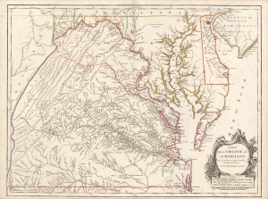
Carte de la Virginie et du Maryland Dressée sur la grande carte Angloise de Mrs. Josué Fry et Pierre Jefferson, Par le Sr. Robert de Vaugondy Géographe.
$2,200.00
Acquire
- Digital Map Information
- Suitable for large format printing
- Full resolution TIFF file
- ICC color profile embedded
- Delivered instantly via download link
This is Robert de Vaugondy's 1755 map of Virginia and Maryland, here in an attractive example of the 1793 5th state. (more details)