
Hiroseidō (廣正堂)

Hiroseidō (廣正堂; fl. c. 1899 – 1904) was an Osaka-based publisher active in the late Meiji period. Only a few of their publications have been cataloged, including a map of East Asia during the Russo-Japanese War, a collection of Hokusai prints, and illustrations of the 5th National Industrial Exhibition held in Osaka in 1903.
AKA: 廣正堂
Illustrates the Russo-Japanese War on a local, regional, and global scale.
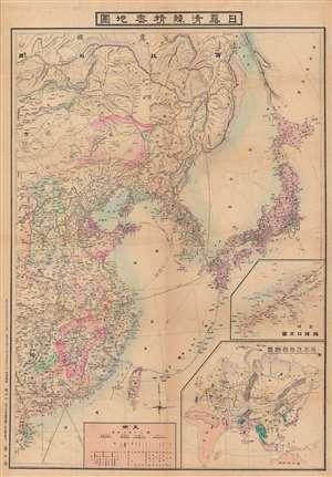
日露清韓精密地圖 / [Precise Map of Japan, Russia, China, and Korea].
$850.00
Acquire
- Digital Map Information
- Suitable for large format printing
- File Size: 100.83 MB
- File Type: ZIP / TIFF
- ICC color profile embedded
- Delivered instantly via download link
This is a visually impressive 1904 Kashima Nagatoshi (鹿島長壽) map of East Asia, made in the opening months of the Russo-Japanese War. Although it clearly alludes to the ongoing conflict, this map is somewhat unusual for also placing the convlict in Northeast Asia in a much wider regional and global context. (more details)