
Honter, Johannes
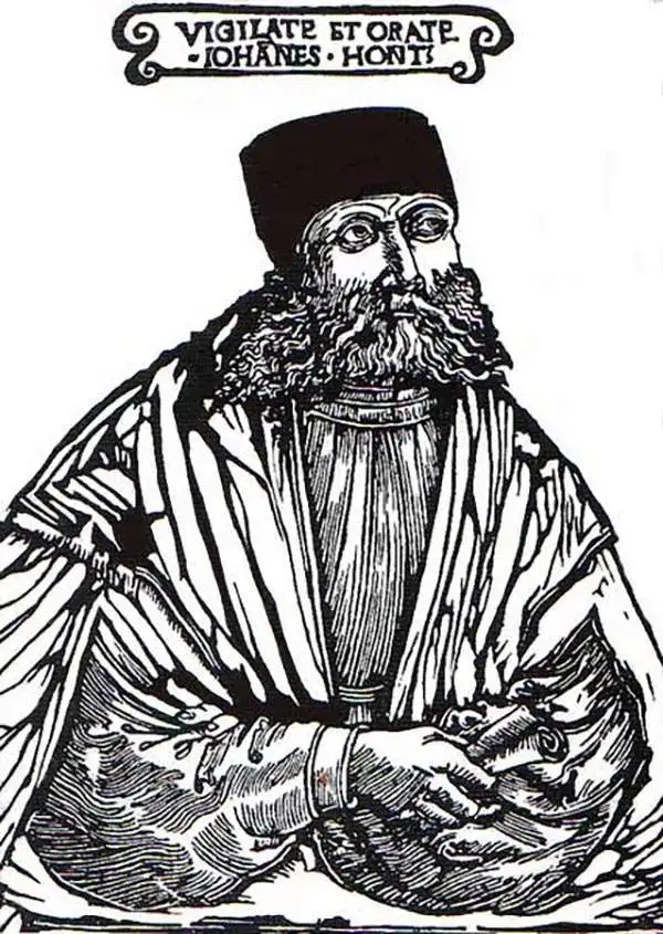
Johannes Honter (1498-1549) was a Transylvanian cartographer, born in Kronstadt (now Brasov, Romania.) Nothing is known of his youth, but he was sufficiently educated to enroll in the university of Vienna in 1515, and receive his bachelor's degree in 1517 and his master's in 1525. The university was rich in humanists and cosmographers; he was a classmate of Peter Apian. It is just as well he was there: in the 1520s Transylvania under assault by the Turkish Army, and the Hungarian army was knocked back on its heels. He eventually had to flee Vienna in the face of the 1529 Turkish siege of the city. The next year would find him at the University of Krakow; while there he published a grammar and his cosmography, Ioannis Honter Coronensis Rudimentorum cosmographiae... In 1531 he traveled to Basel, to work as a proofreader. While there, he met Simon Grynaeus and publisher Heinrich Petri, as well as Sebastian Münster. He appears to have worked as a formschneider in Basel as well. His first full size map was his 1532 Chorographia Transylvaniae, Sybembürgen, the first printed map of that region. But he was unsatisfied with the work and prevented it from being broadly distributed. Only a single copy of the map survives, although a copy appears to have reached at least Joahannes Sambucus, whose Transylvania map copied Honter's. It also constituted the basis for Sebastian Münster's map of the place. Ortelius' maps of Transylvania, though credited to Sambucus, can be recognized as containing Honter's cartography. He would return to Kronstadt in 1533, where he would become involved in public affairs, and would work to establish Lutheranism in his homeland. To this end he started a school and a printing press. He did not neglect cosmography: he published a verse cosmography in 1542 which contained thirteen woodcut maps, which he executed himself.
Earliest acquirable map of Transylvania.
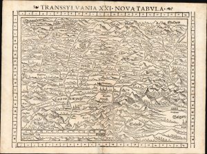
Transsylvania XXI. Nova Tabula.
$850.00
Acquire
- Digital Map Information
- Suitable for large format printing
- Full resolution TIFF file
- ICC color profile embedded
- Delivered instantly via download link
This is a superb example of Sebastian Münster's modern map of Transylvania (part of modern-day Romania) in the desirable 1552 Geographia edition, the only one to include distinctive coordinate borders. It is the earliest acquirable derivative of Johannes Honter's foundational 1532 map of his homeland, Chorographia Transylvaniae. Sybembürgen. Honter's work, a woodcut printed on two sheets, was the first printed map of Transylvania, but Honter was dissatisfied with his work and suppressed it, resulting in the survival of only a single example. Münster's single-sheet copy of Honter's map, first appearing in the 1544 edition of Cosmographia, is thus the earliest acquirable iteration of the first map of this region. (more details)
Transylvania, from the first modern atlas.
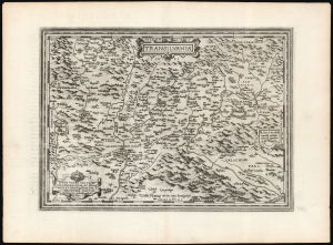
Transilvania / Hanc ultra Transilvaniam, quae et Panodacia, et Dacia Ripēsis, vulgo Sibemburgē Dicitur, edidit Viennae Ao. 1566 Nobiliss. atque Doctiss. Ioês Sâbucus Pannonius.
$750.00
Acquire
- Digital Map Information
- Suitable for large format printing
- DPI: 600
- File Size: 54.14 MB
- File Type: ZIP / TIFF
- ICC color profile embedded
- Delivered instantly via download link
This is Abraham Ortelius' 1575 map of Transylvania, from the first modern atlas, covering what is now central Romania. It is a superb engraving, dramatically presenting the mountains and forests of this frontier region of Europe and the Turkish Empire. (more details)
First edition of Mercator's Map of Transylvania.
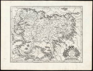
Transylvania.
$750.00
Acquire
- Digital Map Information
- Suitable for large format printing
- DPI: 600
- File Size: 44.51 MB
- File Type: ZIP / TIFF
- ICC color profile embedded
- Delivered instantly via download link
This is a superb example of Gerard Mercator's 1595 map of Transylvania, covering what is now central Romania, in its first edition. (more details)