
Kurz, Louis

Louis Kurz (1854 - 1942) was a Swiss professional musician and a mountaineer. Born in Neuchâtel, Switzerland, Kurz authored the excellent Guide de la Chaîne du Mont Blanc, published in 1892. He explored throughout the region and was known for his work as a surveyor.
Making Mont Blanc (Relatively) Accesible.
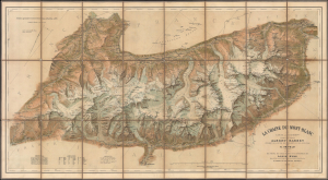
Le Chaine du Mont-Blanc.
$2,500.00
Acquire
- Digital Map Information
- Suitable for large format printing
- Full resolution TIFF file
- ICC color profile embedded
- Delivered instantly via download link
This is a c. 1905 large-format chromolithographed folding map of Mont Blanc and environs on the French-Italian-Swiss border, prepared by Xaver Imfeld. Generally known as 'The Imfeld Map', at the time it was considered the finest map of the mountain, the highest in the Alps, and the surrounding region yet produced. It also coincided with the advent of popular mountaineering in the Alps, including the creation of alpine clubs and the establishment of infrastructure (with shelters, trails, and, of course, maps) to facilitate participation by a wider share of the public. (more details)