
Maire, Nicolas

Nicolas Maire (fl. 1803 - 1840) was a French engraver active in Paris in the late 18th and early 19th centuries. Little is known of his early years during the chaotic days of the French Revolution, but some argue that he was a military engineer under Louis Brion de la Tour (1743 - 1803). During the First Empire, under Napoleon Bonaparte, he established himself as a commercial cartographer, leverage the expanding empire's growing access to cartographic data. He successfully negotiated the political upheavals after the Battle of Waterloo, acquiring the prestigious post of Ingenieur et Geographe du Roi during the Bourbon Restoration of Louis XVIII (1755 - 1824). Maire was an early pioneer of data visualization through maps - and most of his maps are correspondingly data rich and large. In 1821, he published an Atlas Administratif de Pairs which employed a unique template and coding system to visualize urbanization data. He also issued an impressive and rare mineralogical map of Italy, as well as other significant thematic pieces.
The City of Light just before the July Revolution.
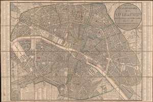
Nouveau Plan Itinéraire de la Ville de Paris divisé en 12 Arr. avec tous les Edifices publics.
$950.00
Acquire
- Digital Map Information
- Suitable for large format printing
- Full resolution TIFF file
- ICC color profile embedded
- Delivered instantly via download link
This is a beautifully engraved 1833 Nicolas Maire and Eugène Andriveau-Goujon city plan or map of Paris, France. Predating Baron Hausmann's renovation of Paris, the city's iconic jumble of large boulevards and small streets leaps off the page. Nearly every illustrated street is identified. Sites notesd include the Louvre, the Invalides, Notre Dame, and the Jardin des Tuileries. Today's Jardin des Plantes, a popular park, is labeled as the Jardin du Roi and the Place de la Concorde is the Place Louis XVI. (more details)
Reorder Europe after Napoleon.
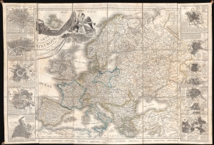
Carte Itinéraire et Politique D'Europe d'après les derniers traités de paix, avec les Plans des principales villes d'Europe.
$650.00
Acquire
- Digital Map Information
- Suitable for large format printing
- Full resolution TIFF file
- ICC color profile embedded
- Delivered instantly via download link
A large-scale 1836 map of Europe by Nicolas Maire, issued in the heady years of the early 19th century, when Europe, still reeling from the Napoleonic Wars (1803 - 1815), politically redefined itself. (more details)