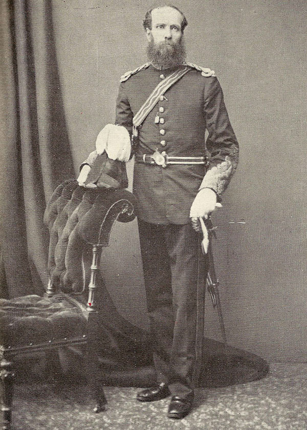
Thomas George Montgomerie (April 23, 1830 - January 31, 1878) was a Scottish geodesist, military officer, and explorer active in India in the mid to late 19th century. Montgomerie was born in Ayrshire, Scotland. He studied first at the East Indian Company Military Seminary in Addiscombe, then at the Royal School of Military Engineering in Chatham. On graduating, he joined the Bengal Sappers, serving one year in Roorkee, India. On his own request, he was transferred to serve under Andrew Scott Waugh (1810 - 1878) on the Great Trigonometrical Survey of India (TSI), then underway. Under Scott, he ran baselines at Attock (Punjab) and Karachi. In 1855, Montgomerie was given leadership of the geodetic and trigonometric survey of Kashmir and Jammu, an area then largely unknown and unpenetrated by the British. The position was both politically sensitive and physically taxing. Montgomerie had to maintain positive relations with the Maharaja while tackling the world's most rigorous mountain terrain and avoiding confrontations associated with the 1857 Sepoy Rebellion. His large map of Kashmir, published in 1859, is a monument to diplomacy, meticulous trigonometry, mountaineering, and dogged tenacity. In 1860, Montgomerie pioneered the idea of using native Indian surveyors, the legendary Pundits, to map Tibet, a kingdom then forbidden to the British on pain of death. While leading this effort, he named the mountains of Karakorum with a novel numerical system, K1 (Masherbrum), K2, K3 (Gasherbrum IV), etc. In 1863, declining health forced him back to England. He returned to India in 1867, where he was assigned to the Himalayan Survey in Uttarakhand. There he headed Pundit efforts in the trans-Himalaya until 1873, when failing health once again forced him back to England. He formally retired from military service in 1876, having reached the rank of Colonel. He died two years later in Bath, England.