1859 Montgomerie Survey of India Wall Map of Kashmir
Kashmir-montgomerie-1859$7,000.00


Title
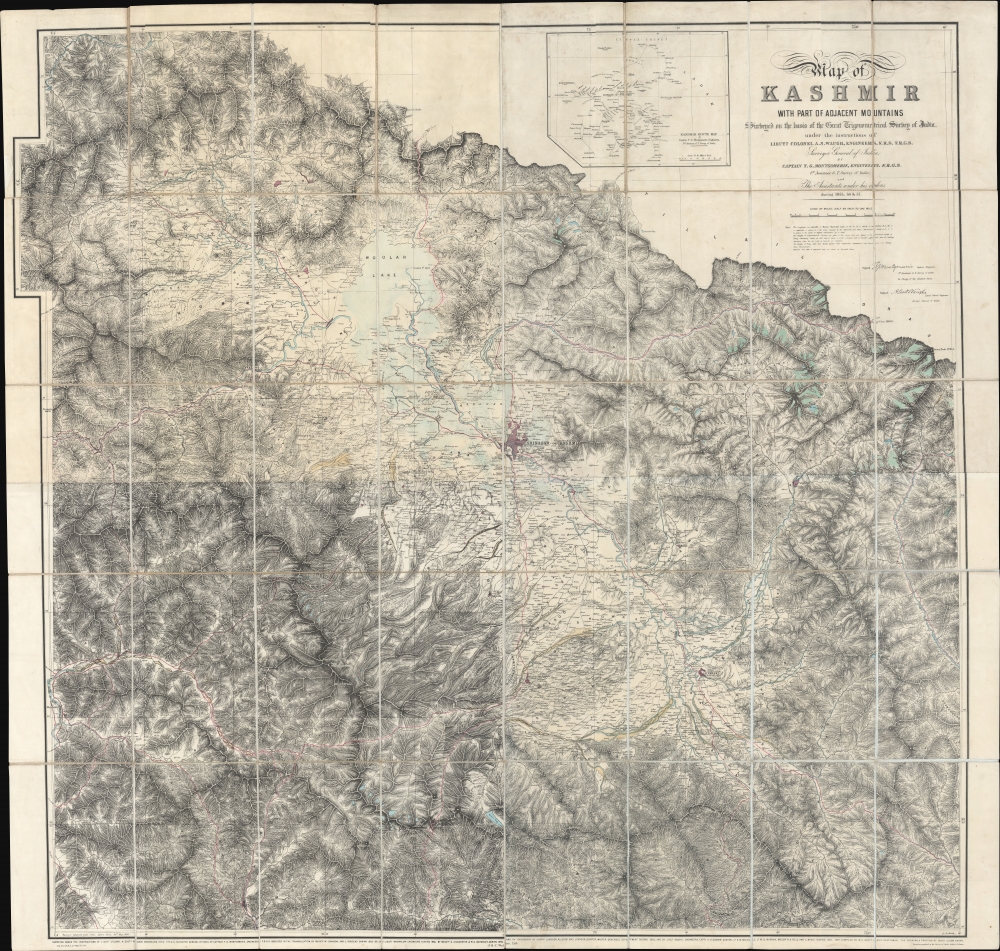
Map of Kashmir with part of Adjacent Mountains surveyed on the basis of the Great Trigonometrical survey of India, under the instructions of Lieutt. Colonel A. S. Waugh, Engineers, F.R.S. F. R.G.S. Survey General of India, by Captain T. G. Montgomerie, Engineers. F.R.G.S. 1st. Assistants under his orders, during 1855, 56 and 57.
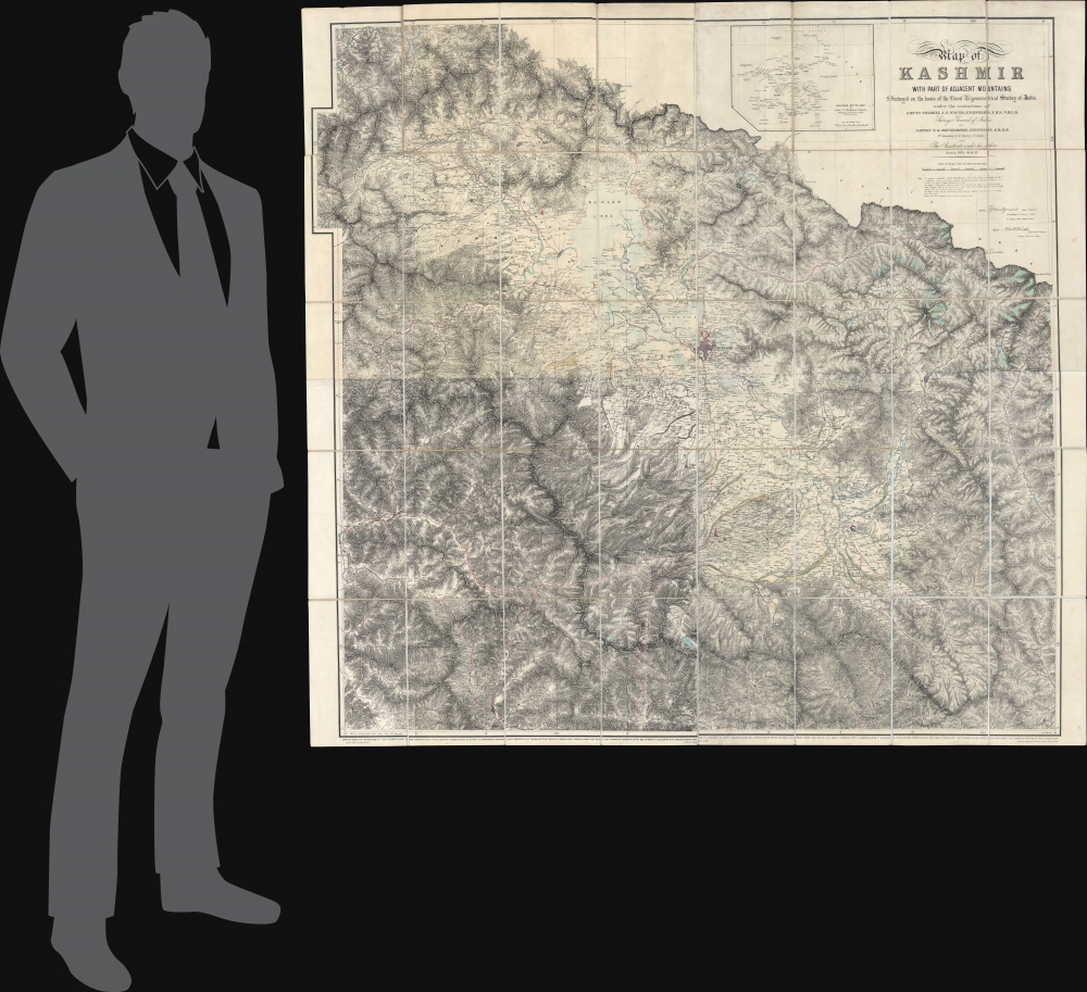
1859 (dated) 50 x 53 in (127 x 134.62 cm) 1 : 126720
1859 (dated) 50 x 53 in (127 x 134.62 cm) 1 : 126720
Description
This is the first edition of Thomas G. Montgomerie's 1859 large-scale map of Kashmir and Jammu - considered the greatest achievement of one of the most epic concerted cartographic efforts in history, the Great Trigonometrical Survey of India.
A Closer Look
Centered roughly on Srinagar, coverage embraces the Vale of Kashmir and the surrounding mountains, comprising modern-day Kashmir and Jammu. The almost entirely mountainous region is meticulously mapped, with topography illustrated by shading, elevations noted, waterways incorporated, and paths between villages and cities illustrated. Blue tinting indicates glaciers and lakes. This map is an unprecedented achievement. When Montgomerie was assigned to map Kashmir, the British only tenuously understood the mountainous region, and it had never been subject to a mathematical survey. Moreover, working from 1855 to 1857, Montgomerie had to balance fraught diplomatic relations with the local Maharaja Gulab Singh, political instability associated with the Sepoy Mutiny (1857), and the navigation of near impenetrable mountains. H. M. Vibart in Addiscombe, its Heroes and Men of Note (1894) described Montgomerie and his team's work:The field of these labours embraced one of the most stupendous mountain tracts in the world, and certainly the most gigantic group of existing glaciers not polar. Many of the stations of observation exceeded 15,000 ft. in height - while a good many ranged from 18 to 20,000, and in one case the theodolite was set up on a peak near the Chang Chenmo Pass 20,866 ft. above the sea. The success which attended the whole of the prolonged observations to their close, was due, first, to his excellent administration and method; and secondly, to the strong personal regard that existed between the head of the Survey and his assistants.
Publication History and Census
This map was surveyed by a team headed by Thomas G. Montgomerie in the years 1855, 56, and 57. It was compiled and drafted at the Survey of India offices in Dehra Dun by Andrew Scott Waugh, then sent to Calcutta in 1859 to be photozincographed by Sheik Golam Kadar. The map was then sent to London, where J. and C. Walker were contracted for the final printing.CartographerS
Survey of India (1767 - Present) is India's central engineering agency in charge of mapping and surveying the country. It was founded in 1767 by Major James Rennell, who took the post of first Surveyor General, with the mission to map and consolidate the territories of the British East India Company. The Survey undertook the Great Trigonometrical Survey between 1802 and 1852 in an attempt to accurately measure the Indian Subcontinent - considered one of the greatest feats of mapping of all time. It also sponsored clandestine surveys, at times disguised as Buddhist pilgrims, to infiltrate and map Tibet, then a closed country. With India's independence in 1947, the Survey was folded into the new Indian government, which it remains part of to this day. More by this mapmaker...
Thomas George Montgomerie (April 23, 1830 - January 31, 1878) was a Scottish geodesist, military officer, and explorer active in India in the mid to late 19th century. Montgomerie was born in Ayrshire, Scotland. He studied first at the East Indian Company Military Seminary in Addiscombe, then at the Royal School of Military Engineering in Chatham. On graduating, he joined the Bengal Sappers, serving one year in Roorkee, India. On his own request, he was transferred to serve under Andrew Scott Waugh (1810 - 1878) on the Great Trigonometrical Survey of India (TSI), then underway. Under Scott, he ran baselines at Attock (Punjab) and Karachi. In 1855, Montgomerie was given leadership of the geodetic and trigonometric survey of Kashmir and Jammu, an area then largely unknown and unpenetrated by the British. The position was both politically sensitive and physically taxing. Montgomerie had to maintain positive relations with the Maharaja while tackling the world's most rigorous mountain terrain and avoiding confrontations associated with the 1857 Sepoy Rebellion. His large map of Kashmir, published in 1859, is a monument to diplomacy, meticulous trigonometry, mountaineering, and dogged tenacity. In 1860, Montgomerie pioneered the idea of using native Indian surveyors, the legendary Pundits, to map Tibet, a kingdom then forbidden to the British on pain of death. While leading this effort, he named the mountains of Karakorum with a novel numerical system, K1 (Masherbrum), K2, K3 (Gasherbrum IV), etc. In 1863, declining health forced him back to England. He returned to India in 1867, where he was assigned to the Himalayan Survey in Uttarakhand. There he headed Pundit efforts in the trans-Himalaya until 1873, when failing health once again forced him back to England. He formally retired from military service in 1876, having reached the rank of Colonel. He died two years later in Bath, England. Learn More...
Andrew Scott Waugh (February 3, 1810 - February 21, 1878) was a British geodesist and army officer active in India in the mid-19th century. Waugh was born in Madras, India, the son of Gilbert Waugh, a military auditor-general. He studied at the Addiscombe Military Seminary (Edinburgh) and the Royal School of Military Engineering (Chatham). He was sent to India in 1827 with the Bengal Engineers, serving at Kashipur and then with the Bengal Sappers through 1831. In 1832, having distinguished himself as a military engineer, he was posted to the Great Trigonometrical Survey under George Everest (1790 - 1866). Under Everest, he conducted surveys throughout India through 1843. When Everest retired, he recommended Waugh to succeed him in Dehra Dun as Surveyor General of India. In 1852, under Waugh, the Survey of India trigonometric team calculated the height of Mount Everest. Waugh named the mountain, discovered to be the highest in the world, after his predecessor. Waugh left India in 1861, returning to London where he was active in the Royal Geographical Society. He died there in 1878. Learn More...
Condition
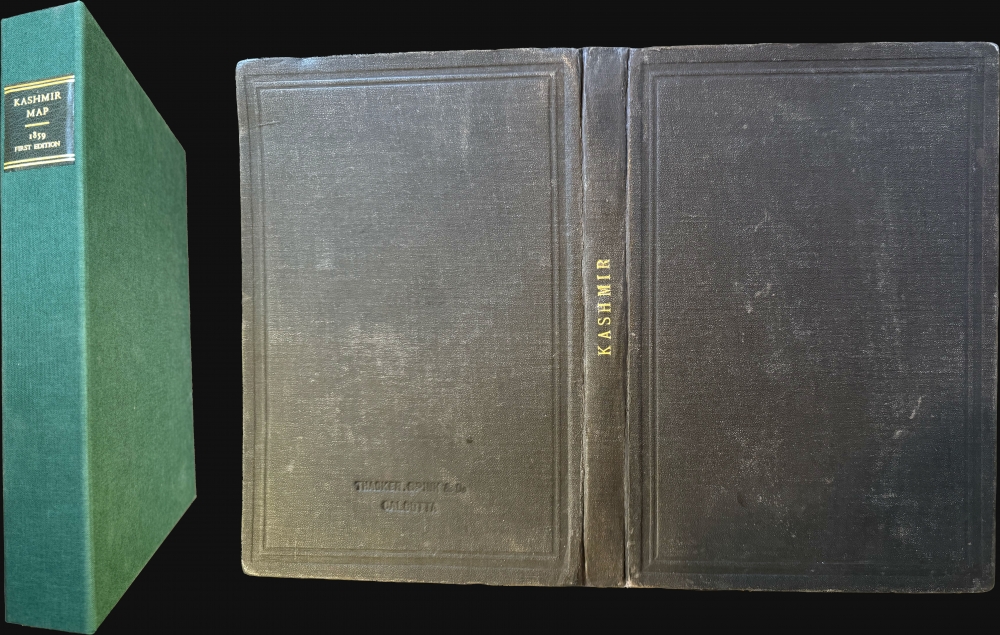
Very good. Some tone variance between quadrants. Some wear on old linen backing, but generally stable. Minor tear to backing, upper left corner, not affecting paper map. Accompanied by original stamped binder and enclosed in modern linen clamshell box, with gilt-stamped leather label.