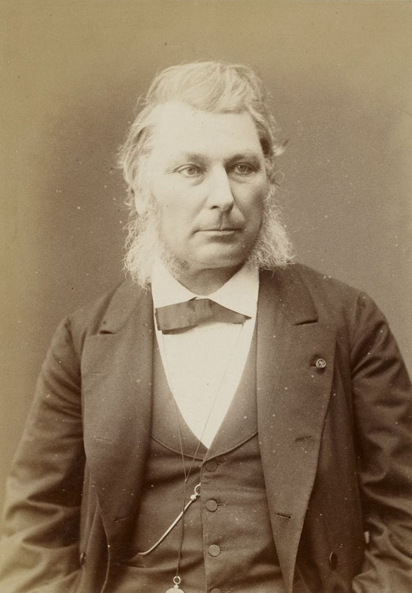
Ernest Amédée Barthélemy Mouchez (1821 – 1892) was a French naval officer and hydrographer. Mouchez was born in Madrid, but started his career with the French Navy in 1843. Although he was famed for his heroic defense of the port of Le Havre during the Franco-Prussian war, his experience with the navy was primarily one of exploration, rather than warfare. He served on surveys of the coasts of Algeria, Korea, and China, but most particularly South America; he would publish in 1868 Positions géographiques des principaux points de la cote orientale de l'Amérique du Sud comprise entre la Guyane française et le Paraguay d'après les campagnes du Bisson, du D'Entrecasteaux et du Lamotte-Piquet, de 1856 a 1866, a gazeteer of the latitudes and longitudes of points along the South American coast; his surveys also informed navigational manuals of the Rio de la Plata, and a detailed map of the Paraná province. From 1857 to 1859 he executed extensive surveys of the Paraguay River, and several maps and charts of Paraguay and the Plata region cite his efforts. He appears to have engaged in an in-depth study also of Paraguay under the leadership of the dictatorial President Carlos Antonio López Ynsfrán (1792-1862). His efforts apparently earned him the ire of that President, and what appear to have been completely justified accusations of espionage. A detailed manuscript study of Portugal under Lopez survives, but was never published: Mouchez's surveys and astronomical efforts were well-published so it appears likely that if he had wished to publish the Paraguay survey, he could well have done: after all, just a few years later under Lopez's son Paraguay would be embroiled in the notorious war of the Triple Alliance. It may be that Mouchez's study was meant for the eyes of the French Government, rather than general publication.
Mouchez's efforts in the realm of navigation and astronomy were well regarded. He contributed new techniques for surveying at sea and precisely determining longitude. In 1873 he was elected to the Bureau des Longitudes. in 1874 he was sponsored by the Académie des sciences to observe the transit of Venus from St. Paul Island in the Indian Ocean, resulting in a remarkable photographic record of the transit. By 1875 he was a member of the astronomy section of the Académie. Appointed in 1778 director, and tasked with the reconstruction of the Paris Observatory, which had become ruined during the course of the 1870 war and the 1871 Paris Commune. Late in life he collaborated with Sir David Gill to produce a photographic celestial atlas, the Carte du Ciel, a project which stalled and faded as it became superceded.
Mouchez's efforts in the realm of navigation and astronomy were well regarded. He contributed new techniques for surveying at sea and precisely determining longitude. In 1873 he was elected to the Bureau des Longitudes. in 1874 he was sponsored by the Académie des sciences to observe the transit of Venus from St. Paul Island in the Indian Ocean, resulting in a remarkable photographic record of the transit. By 1875 he was a member of the astronomy section of the Académie. Appointed in 1778 director, and tasked with the reconstruction of the Paris Observatory, which had become ruined during the course of the 1870 war and the 1871 Paris Commune. Late in life he collaborated with Sir David Gill to produce a photographic celestial atlas, the Carte du Ciel, a project which stalled and faded as it became superceded.