
Reale Officio Topografico

The Reale Officio Topografico (Royal Topographical Office) (1781 - 1879) was a Neopolitan military scientific institute based in Naples that made topographic, geographical, and hydrographic maps for the Kingdom of the Two Sicilies. Founded by Giovanni Antonio Rizzi Zannoni in 1781, the Office created an incredible reputation during its existence, becoming one of the best topographic offices in Europe and an important point of reference for other European cartographic institutions. By 1855, there were five bureaus: library, machine and instrument cabinet and observatory; internal works (drawings and engravings); large-scale typography, chalcography, lithography and models of fortresses; topographic section of Palermo; and geodetic and topographic works. After the unification of Italy, the Kingdom of Italy formed what became the Military Geographical Institute in Florence. The Reale Officio Topografico survived as a branch of this organization until it was 'definitively suppressed' in 1879.
Best Sicily map of its generation.
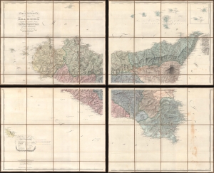
Carta Generale della Isola di Sicilia Compilata Disegnata ed Incisa Nell'Officio Topografico di Napoli su I Migliori Materiali Esistenti e sulle recenti operazioni fatte Dal Cavaliere Guglielmo Errico Smyth Capitano delle Reale Marina Brittannica.
$2,800.00
Acquire
- Digital Map Information
- Suitable for large format printing
- Full resolution TIFF file
- ICC color profile embedded
- Delivered instantly via download link
One of the greatest maps of Sicily, this is the 1826 Officio Topografico di Napoli wall map of Sicily compiled from surveys undertaken by William Henry Smyth, a British Royal Navy hydrographer active during the Napoleonic Wars (1803 - 1815). The Smyth surveys were expanded and refined by the Officio Topografico to accommodate administrative use under the newly established Kingdom of the Two Sicilies. At the time, Sicily was openly rebellious and generally dissatisfied with the incompetent administration of Naples. This piece represents a revolution in the cartographic representation of Sicily, surpassing in content and precision the 1779 Orcel / Schmettau map, considered for nearly 50 years the premier map of Sicily. (more details)