1826 Officio Topografico di Napoli Wall Map of Sicily, Italy
Sicilia-offtoponapoli-1826$2,800.00


Title
Carta Generale della Isola di Sicilia Compilata Disegnata ed Incisa Nell'Officio Topografico di Napoli su I Migliori Materiali Esistenti e sulle recenti operazioni fatte Dal Cavaliere Guglielmo Errico Smyth Capitano delle Reale Marina Brittannica.
1826 (dated) 44.25 x 56.25 in (112.395 x 142.875 cm) 1 : 270000
1826 (dated) 44.25 x 56.25 in (112.395 x 142.875 cm) 1 : 270000
Description
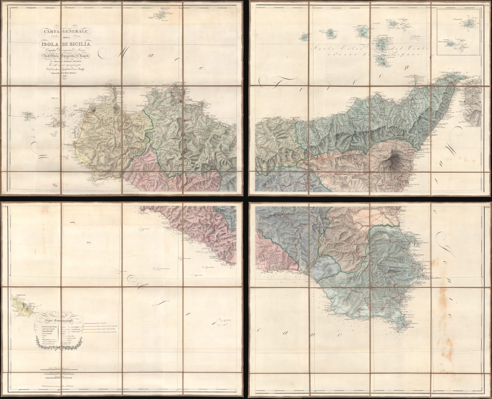
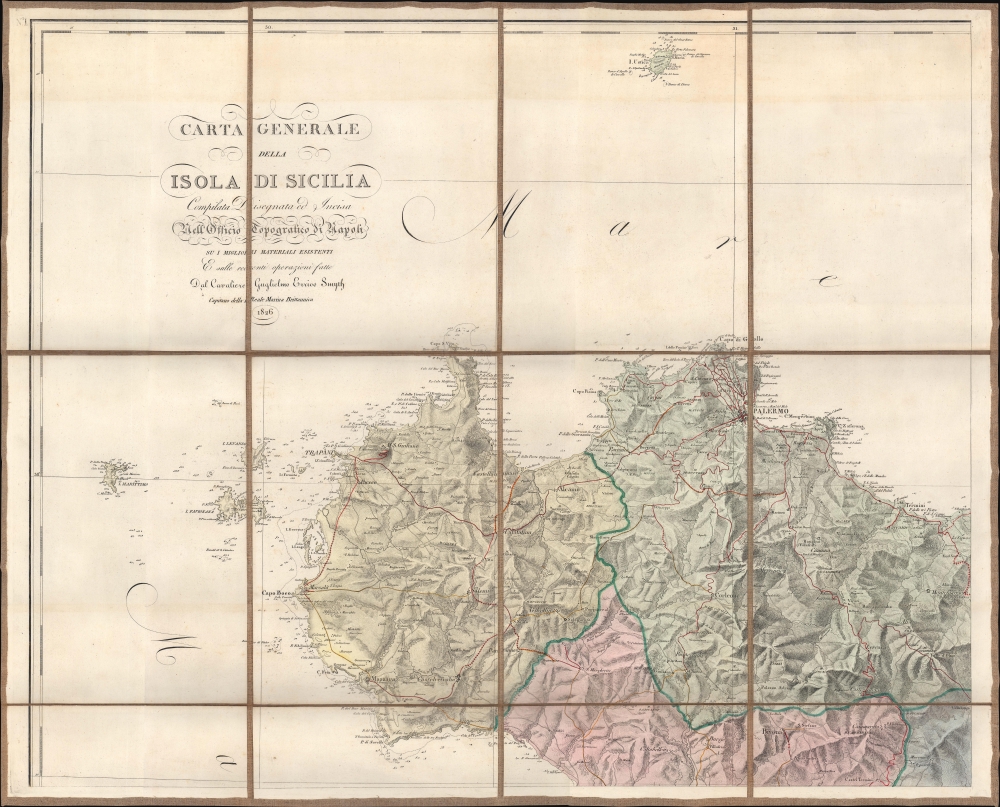
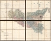
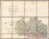
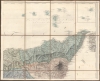
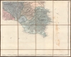
One of the greatest maps of Sicily, this is the 1826 Officio Topografico di Napoli wall map of Sicily compiled from surveys undertaken by William Henry Smyth, a British Royal Navy hydrographer active during the Napoleonic Wars (1803 - 1815). The Smyth surveys were expanded and refined by the Officio Topografico to accommodate administrative use under the newly established Kingdom of the Two Sicilies. At the time, Sicily was openly rebellious and generally dissatisfied with the incompetent administration of Naples. This piece represents a revolution in the cartographic representation of Sicily, surpassing in content and precision the 1779 Orcel / Schmettau map, considered for nearly 50 years the premier map of Sicily.
The Best Map of Sicily
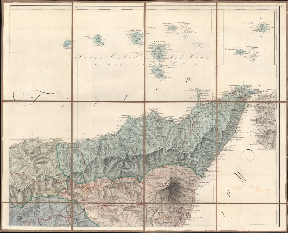
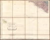
The map consists of sixty-four (64) dissected panels mounted in 4 linen-backed sections. Red lines trace the island's major roadways (labeled as 'carriageways' in the legend), while crosses mark projected roadways and yellow illustrates roads under construction. The Aeolian Islands are illustrated above Sicily, with Panaria and Stromboli appearing in an inset in the upper right. The coastal detail on the present map is drastically improved over the 1779 Orcel / Schmettau map. Depth soundings, capes, islands, and other coastal features appear here that were not known to Schmettau. The road network is much more extensive than that depicted by the Orcel (arguably because of the 47 years between the publication of the Orcel and this map). Inland detail is much more developed as well - reflecting access to additional localized surveys.Smyth and Sicily
William Henry Smyth (January 21, 1788 - September 8, 1865) served in the British Royal Navy from 1804 until 1846. After fighting in the defense of Cadiz and off the coast of Spain through 1812, Smyth was assigned to the Sicilian flotilla on March 25, 1813. During this time, he was based in Naples and fighting against the French in the Mediterranean but he spent the rest of his time doing antiquarian research and undertaking unofficial hydrographic surveys. He was awarded the Order of Saint Ferdinand and of Merit by King Ferdinand I for his services in defending Sicily. After the Napoleonic Wars, Smyth remained in command of the brig Scylla. He continued to survey the Sicilian coast, along with the coast of Italy and North Africa. He was transferred to the Aid in 1817, a more formal posting where he continued his survey work in Sicily, along with surveys of the Greek, Italian, and African coasts. Smyth's information, undoubtedly the best available at the time, was used by the Officio Topografico di Napoli when creating this magnificent map.The Kingdom of the Two Sicilies
This map was published ten years after the founding of the Kingdom of the Two Sicilies (1816 - 1860), the largest sovereign state in Italy prior to unification. The kingdom was founded in 1816 by Ferdinand IV of Bourbon after he abolished the Sicilian constitution, erasing the Kingdom of Sicily (which had existed for 800 years), and taking the royal title, Ferdinand I. The people of Sicily rebelled against this violation of their historical rights and founded secret anti-monarchal societies, including the Carbonari. This led to the planned revolution of 1820, which was violently suppressed by Neapolitan and Austrian troops. A second revolution in 1848-49 was also suppressed by Neapolitan forces. This push for independence included the five-day bombardment of Messina by King Ferdinand II of the Two Sicilies, earning him the nickname Re Bomba. Giuseppe Garibaldi invaded Sicily in 1860, and by February 1861 had successfully conquered the entire kingdom. Garibaldi transferred the conquered kingdom to King Victor Emmanuel, which was annexed to the Kingdom of Sardinia and became the Kingdom of Italy in 1861.Publication History and Census
This map was created and published by the Officio Topografico di Napoli in 1826 from surveys completed by William Henry Smyth. We note seven examples cataloged in OCLC which are part of the collection at the Bayerische Staatsbibliothek, the Universitätsbibliothek München, the University of London, the Zentralbibliothek Zürich, the Bibliothèque nationale de France, and the Erfgoedbibliotheek Hendrik Conscience in Antwerp, Belgium. We have located an eighth cataloged example in the collection of the Biblioteca regionale universitaria di Catania. We have found no sales record of this map on the private market.CartographerS
The Reale Officio Topografico (Royal Topographical Office) (1781 - 1879) was a Neopolitan military scientific institute based in Naples that made topographic, geographical, and hydrographic maps for the Kingdom of the Two Sicilies. Founded by Giovanni Antonio Rizzi Zannoni in 1781, the Office created an incredible reputation during its existence, becoming one of the best topographic offices in Europe and an important point of reference for other European cartographic institutions. By 1855, there were five bureaus: library, machine and instrument cabinet and observatory; internal works (drawings and engravings); large-scale typography, chalcography, lithography and models of fortresses; topographic section of Palermo; and geodetic and topographic works. After the unification of Italy, the Kingdom of Italy formed what became the Military Geographical Institute in Florence. The Reale Officio Topografico survived as a branch of this organization until it was 'definitively suppressed' in 1879. More by this mapmaker...
William Henry Smyth (January 21, 1788 - September 8, 1865) was a British hydrographer, Royal Navy officer, numismatist, and astronomer. Born in London, Smyth ran away from home at fourteen and became a cabin boy on a merchant ship. When the ship was commandeered by the Royal Navy, Smyth began his naval career as an ordinary seaman. He served with distinction during the Napoleonic Wars (1803 - 1815), spending from 1804 through 1808 in the Pacific and in the waters off India, China, and Australia. From 1809 through 1815 he served in Europe, participating in the defense of Cadiz and the defense of Sicily. He was promoted to lieutenant on March 25, 1813, and then to Commander on September 18, 1815. With this promotion he was placed in command of the brig Scylla which he used to continue the hydrographic survey work and his surveys off the coast of Sicily, along with the adjacent shorts of Italy, and the North African coast. He transferred to the Aid in 1817 and continued his survey work along the Italian, Sicilian, Greek, and African coasts. These surveys resulted in the creation of numerous charts, which were used by the Royal Navy until the mid-20th century. He met the astronomer Giuseppe Piazzi in Palermo in 1817 and visited his observatory, which sparked an interest in astronomy. He was promoted to Post-Captain in 1824, which ended his service at sea with the Royal Navy. He settled in Bedford, England, in 1825, and established his own private observatory. From here he observed nebulae, star clusters, and double stars, leading him to publish Cycle of Celestial Objects in 1844. This book earned him the Gold Medal of the Royal Astronomical Society in 1845 and the presidency of the society. He retired from the Navy in 1846 on half-pay, and was promoted to Rear-Admiral, Vice-Admiral, and finally Admiral on November 14, 1863. He was awarded the Royal Geographical Society's Founder's Medal in 1854 for his survey work in the Mediterranean. Learn More...
Condition
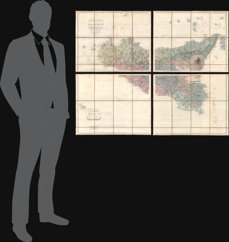
Very good. Four separate sheets. Dissected and mounted on linen in sixty-four (64) panels. Wear along linen fold lines. Some soiling.
References
Biblioteca regionale universitaria di Catania 2.NC.MISC.(C) /(1) /173. OCLC 165582100, 1283355780, 764363592, 902468138.