
Riedel, Johann Michael Eric

Johann Michael Eric Riedel (December 2, 1865 - February 10, 1948), generally known as 'John', was a German-American architect and mapmaker based in Fort Wayne, Indiana in the late 19th and early 20th centuries. Riedel was born in St. Louis, Missouri to German immigrant parents. His family relocated to Fort Wayne as a child and lived there for most of his life. He began practicing as an architect around 1889, becoming prominent by about 1900. He built several significant structures around the city. Starting in the early 20th century, he also issued a folding pocket map of Fort Wayne, which remained in publication with regular updates at least until 1930. Riedel died of heart problems in 1948.
Fort Wayne's Interurban railways and streetcar lines.
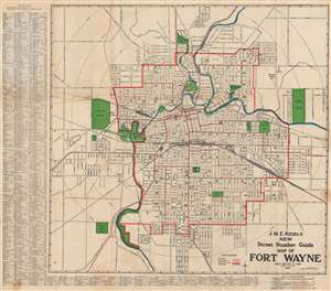
J. M. E. Riedel's New Street Number Guide Map of Fort Wayne.
$250.00
Acquire
- Digital Map Information
- Suitable for large format printing
- Full resolution TIFF file
- ICC color profile embedded
- Delivered instantly via download link
This is a 1919 John M. E. Riedel city plan or map of Fort Wayne, Indiana. Red overprinting highlights streetcar lines within Fort Wayne and interurban railways, such as the Fort Wayne and Northern Indiana Traction Company. Railroads (which went farther than interurban railways) are illustrated by black lines. Numerous railroads traveled through Fort Wayne, including the Pittsburgh, Fort Wayne, and Chicago Railway (part of the Pennsylvania railroad system), the Wabash Railroad, and the New York, Chicago, and St. Louis Railroad. The public library, Court House, Post Office, Concordia College, and City Hall are identified. An alphabetic street index appears outside the left and bottom borders. (more details)
Uncommon real-estate planning map.
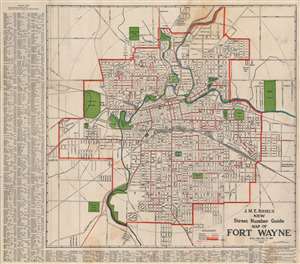
J. M. E. Riedel's New Street Number Guide Map of Fort Wayne.
$200.00
Acquire
- Digital Map Information
- Suitable for large format printing
- File Size: 33.87 MB
- File Type: ZIP / TIFF
- ICC color profile embedded
- Delivered instantly via download link
An attractive 1922 map of Fort Wayne, Indiana by John M. E. Riedel. The map covers the city limits and street grid as they appeared in 1922. This particular examples include some manuscript updates to define 'Walks and Alleys' and 'Sublets to A.G.'. It is not 100% clear what either of these refer to, but the annotations are fairly precise. The pink 'walks' which appear haphazard though the city may refer to sidewalk development. (more details)