
Sanson, Guillaume

Guillaume Sanson (1633 - 1703) was a French cartographer active in the latter part of the 17th century. He is the son of the legendary cartographer Nicolas Sanson (1600 - 1667), and, along with his brother Adrien Sanson (1639 - 1718), took over the family firm on his father's death. Like his father, Guillaume Louis XIV granted him the official title, Geographe Ordinaire du Roy. Much of his work after 1671 was published in collaboration with Alexis-Hubert Jaillot (c. 1632 - 1712). Although the continued to published new maps, particularly Guillaume Sanson, the firm began to lose prestige and market share. In 1692, the brothers sold their geographical archive to their nephew Pierre-Moulart Sanson (1670 - 1730), who published a map catalog in 1696 and reissued the Sanson atlas. After Pierre-Moulart's death, many of the surviving map plates were acquired by Gilles Robert de Vaugondy, setting the stage for another French cartographic dynasty.
Kyiv after Beauplan's Firsthand Survey. During the Russo-Polish War (1654 - 1667).
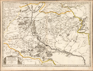
Basse Volhynie, ou Palatinate de Kiow.
$2,000.00
Acquire
- Digital Map Information
- Suitable for large format printing
- Full resolution TIFF file
- ICC color profile embedded
- Delivered instantly via download link
This is a beautifully engraved 1665 map of central Ukraine by Nicolas Sanson. Published during the Russo-Polish War (1654 - 1667), it is the earliest French iteration of the geography of Franco-Polish cartographer, engineer, and architect Guillaume Levasseur de Beauplan. Beauplan produced the best 17th-century survey of the Dniepr and laid the foundation for the modern mapping of Ukraine. (more details)
Correcting the Zambezi. First Amsterdam edition.
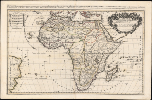
L'Afrique distinguée en ses principales parties, sçavoir La Barbarie, Le Biledulgerid, L'Egypte, Le Saara ou le Desert, Le Pays des Negres, La Guinee, La Nubie, L Abissinie, Le Zanguebar, Le Congo, Le Monomotapa, Les Cafres, Les Iles de Canarie, du Cap-Verd, de St.Thomas, L'Isle Dauphine, autrement Madagascar, ou sont remarqués les Empires, Monarchies, Royaumes, Estats, et peuples qui partagent presentement L'Afrique.Tiré sur les Relations les plus nouvelles. Par le Sr. Sanson, Geographe ordre. du Roy.
$1,800.00
Acquire
- Digital Map Information
- Suitable for large format printing
- DPI: 600
- File Size: 1120.48 MB
- File Type: ZIP / TIFF
- ICC color profile embedded
- Delivered instantly via download link
This is a spectacular 1692 first Pierre Mortier edition of Alexis-Hubert Jaillot and Guillaume Sanson's large-format map of Africa - one of the largest and most beautiful atlas maps of the continent to appear in the 17th century, here in a striking old color example. This map is most significant for it correction of the location of the Zambezi River, correctly placing it north of Sofala. (more details)