
Vance, David H.

David H. Vance (1799 - c. May 29, 1832) was an American mapmaker, surveyor, and engraver based in New York and Philadelphia. Vance is an important if elusive figure. He appears in a ship passenger manifest form 1824 returning from England, where he is identified as a Land Agent and Surveyor. He drafted many of the maps for Anthony Finley's New American Atlas, and engraved several maps for Harty's Modern Atlas. In 1825 - 26 Vance compiled an important large-scale wall map of the United States and a map of the world, both also in partnership with Anthony Finley. In 1825, along with J. Ogden Dey, he completed a seminal map of western New York state.
First Edition of Early American Pocket Map.
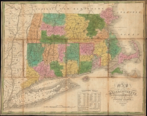
Map of Massachusetts, Connecticut, and Rhode Island constructed from the Latest Authorities.
$600.00
Acquire
- Digital Map Information
- Suitable for large format printing
- File Size: 21.64 MB
- File Type: ZIP / TIFF
- ICC color profile embedded
- Delivered instantly via download link
This is an attractive 1825 folding map of southern New England - Massachusetts, Connecticut, and Rhode Island - produced by Anthony Finley, James H. Young, and David H. Vance. (more details)
Early railroads of New England.
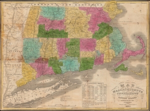
Map of Massachusetts Connecticut and Rhode Island constructed from the latest authorities.
$800.00
Acquire
- Digital Map Information
- Suitable for large format printing
- Full resolution TIFF file
- ICC color profile embedded
- Delivered instantly via download link
A hand-colored 1838 pocket map of Massachusetts, Connecticut, and Rhode Island, published by Flavius Brown and Edward Parsons. It captures the region in the early days of the railroad boom, when both canals and railroads were being proposed and built at a frenetic pace. (more details)