
Ward, John Ward

John Ward (fl. c. 1840 - 1873) was a hydrographic survey officer of the British Royal Navy. Ward joined the Royal Navy in 1840. His first service was in the Bahamas and the West Indies. In 1848 he passed the naval officers exam and in 1850 was promoted to Lieutenant. From 1855 he worked on the Scotland coast completing a detailed survey under Captain H. C. Otter. In 1858, he was promoted to Commander assigned to the H.M.S. Actaon and sent to complete the survey of the China coast and the waters around Japan made during the Second Opium War (1856 - 1860). This position was initially held by Commander William Thornton Bate (January 31, 1818 - December 29, 1857), who was killed in the Second Opium War's Battle of Canton (1857). Bate's second, Lieutenant Chares Bullock (1826 - 1904), took interim command of the survey, to be replaced with Ward in 1858. From 1858 to 1861, Ward and Bullock completed meticulous surveys ranging from Hong Kong to Manchuria and from the Yangtze River to Japan. In 1864 he was promoted to command the Riflemen, but by 1866, returned to England having received an injury. He was nonetheless not retired from active service until 1873.
China Survey from the Second Opium War.
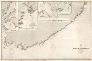
Strelok Bay to St. Vladimir Bay.
$150.00
Acquire
- Digital Map Information
- Suitable for large format printing
- File Size: 55.74 MB
- File Type: ZIP / TIFF
- ICC color profile embedded
- Delivered instantly via download link
This is a rare 1868 Admiralty nautical chart or maritime map of the Pacific coast of Russian Manchuria, just east of Valdivostok. The map is the result of detailed surveys conducted during the Second Opium War Second Opium War (1856 - 1860). The map depicts the coastline in great detail from Nakhodka to St. Vladimir Bay (Zaliv Vladimira). Numerous coastal locations are labeled including several points, islands, rivers, and smaller bays. Depth soundings are noted all along the coast, with the highest concentration around St. Vladimir Bay and America Bay. Four inset maps are situated in the upper left, depicting Tcheniya Bay, Nakhodka Bay, Olga Bay, and Wrangel Bay. Each of these inset maps include numerous depth soundings along with several identified locations. A profile view of the coastline between Olga Bay and St. Vladimir Bay is also illustrated. (more details)