
Wheeler, George Montague

George Montague Wheeler (October 9, 1842 - May 3, 1905) was a surveyor and cartographer best known for leading the U.S. Government's geographical surveys west of the 100th meridian, better known as the Wheeler Survey. Born in Massachusetts, Wheeler attended West Point and graduated near the top of his class in 1866. He joined the Army Corps of Engineers and was dispatched to the American West, before being chosen to lead the ambitious survey that came to be associated with his name, which lasted from 1872 to 1879.
An early geological map of the Grand Canyon region.
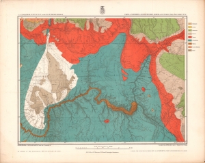
Parts of Northern and North Western Arizona and Southern Utah. Sheet No. 67.
$500.00
Acquire
- Digital Map Information
- Suitable for large format printing
- File Size: 21.85 MB
- File Type: ZIP / TIFF
- ICC color profile embedded
- Delivered instantly via download link
A beautifully chromolithographed geologic map of northern Arizona and environs, including the Grand Canyon, produced by the Wheeler Survey c. 1873 and published in the Topographical Atlas which summarized the survey's work. (more details)
Boulder Canyon before Hoover Dam.
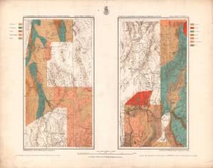
Parts of E. California, S.E. Nevada, N.W. Arizona and S.W. Utah. Atlas Sheet Number 58 / Atlas Sheet Number 66.
$400.00
Acquire
- Digital Map Information
- Suitable for large format printing
- File Size: 20.22 MB
- File Type: ZIP / TIFF
- ICC color profile embedded
- Delivered instantly via download link
An interesting pair of geologic maps of the American West, displaying the region around the Colorado River at Boulder Canyon, not far from the future city of Las Vegas. They were produced by the Wheeler Survey c. 1873 and published in the Topographical Atlas, which summarized the survey's work. (more details)
High Desert and Higher Mountains.
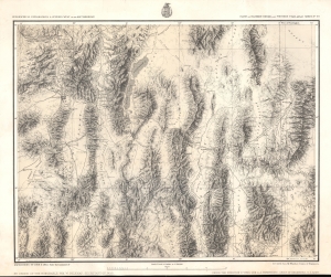
Parts Of Eastern Nevada And Western Utah, Atlas Sheet No. 49.
$350.00
Acquire
- Digital Map Information
- Suitable for large format printing
- File Size: 24.13 MB
- File Type: ZIP / TIFF
- ICC color profile embedded
- Delivered instantly via download link
A detailed c. 1879 George Montague Wheeler survey map of northeastern Nevada and northwestern Utah, issue for the Topographical Atlas Projected to Illustrate United States Geographical Surveys West of the 100th Meridian of Longitude. It is one of the earliest detailed maps of this region and includes interesting details on the Native American and early American inhabitants of the area, including mines, ranches, and early settlements. (more details)
Heartland of the Rockies
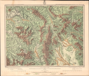
Land Classification Map Of Part Of Central Colorado, Atlas Sheet No. 52 (D).
$350.00
Acquire
- Digital Map Information
- Suitable for large format printing
- File Size: 29.51 MB
- File Type: ZIP / TIFF
- ICC color profile embedded
- Delivered instantly via download link
A chromolithograph survey map of the Rocky Mountains and environs in central Colorado, prepared in 1879 by George Wheeler and associates, representing the first detailed surveys of these lands. (more details)