
Brayer, Alfred Lucien de

Alfred Lucien de Brayer (1816-1894) was a French Count, a draughtsman, painter, and diplomat. He served as French consul to Paraguay beginning in 1855, an appointment he received from Napoleon III. He had initially been tasked with the creation of a French colony across the Paraguay river from Asuncion; he would later struggle to maintain support the interests of French colonists in the face of the increasingly capricious and xenophobic regime of Franciso Solano López. He came from a military family. His grandfather, the French general Michel-Sylvestre Brayer (1769 - 1840), had distinguished himself under Napoleon and paid for his loyalty with exile until 1821: Michel-Sylvestre would begin his family's association with South America, serving with a variety of armies, indluding that of Jose Miguel Carrera in Chile. Michel-Sylvestre's son Lucien de Brayer (1794–1865) was born in Germany and followed his father's trade: in 1828 he commanded a regiment of the Republic of Montevideo, and was a high-ranking officer in Greece supporting the rebellion there against Turkish rule. He died died a military officer in Uruguay in 1865.
Diplomat's synthesis of Paraguayan Geography.
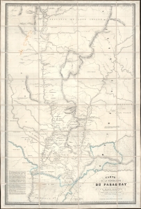
Carte de la Républiuque Du Paraguay dédiée et présentée à sa Majesté Napoléon III Empereur des Français, par le Comte Lucien de Brayer Consul de France au Paraguay. Publiée pat en 1863.
$7,000.00
Acquire
- Digital Map Information
- Suitable for large format printing
- File Size: 62.01 MB
- File Type: ZIP / TIFF
- ICC color profile embedded
- Delivered instantly via download link
This is an extremely rare 1863 map of Paraguay, produced by Alfred Lucien de Brayer, Napoleon III of France's consul to the South American country. It was published to commemorate the 10th year of France's diplomatic recognition of Paraguay's independence and probably as an attempt to bolster de Brayer's damaged reputation with the Emperor. The map is superbly detailed, laying out Paraguay and its frontier regions. It details the administrative regions within the country; neighboring indigenous tribes and nations are noted, as well as the bordering regions of Brazil and Argentina. (more details)
A diplomat's synthesis of Paraguayan Geography.
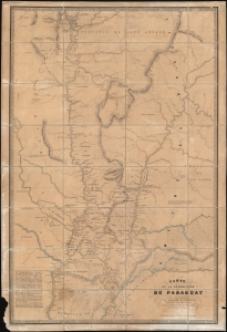
Carte de la Républiuque Du Paraguay dédiée et présentée à sa Majesté Napoléon III Empereur des Français, par le Comte Lucien de Brayer Consul de France au Paraguay.. Publiée pat en 1863.
$7,000.00
Acquire
- Digital Map Information
- Suitable for large format printing
- File Size: 214.29 MB
- File Type: ZIP / TIFF
- ICC color profile embedded
- Delivered instantly via download link
This is an extremely rare 1863 map of Paraguay, produced by Alfred Lucien de Brayer, Napoleon III of France's consul to the South American country. It was published to commemorate the 10th year of France's diplomatic recognition of Paraguay's independence, and probably as an attempt to bolster de Brayer's damaged reputation with the Emperor. The map is superbly detailed, laying out Paraguay and its frontier regions. It details the administrative regions within the country; neighboring indigenous tribes and nations are noted as well as the bordering regions of Brazil and Argentina. (more details)