
Cassini, Giovanni Domenico (Cassini, Jean-Dominique)
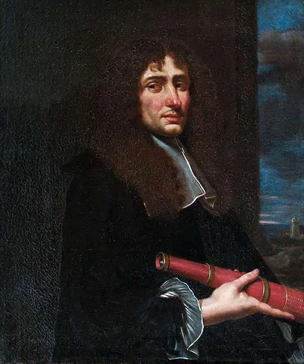
Giovanni Domenico (Jean-Dominique) Cassini (June 8, 1625 - September 14, 1712) was a Savoyard-French astronomer, mathematician, engineer and astronomer. He discovered four of Saturn's moons and observed the division of that planet's rings; he organized a global observation of the eclipses of Jupiter's moons in order to produce the most accurate measure of longitude to date. The data thus gathered he compiled on the famous, eight-meter world map laid out on the floor of the Paris Observatory. He started his family on the path to producing the first topographic map of France using scientific survey, employing the same method of determining longitude. He also produced the first scientific map of the Moon. He was born in Perinaldo, then part of Savoy. Beginning in 1648 he worked and studied at the Panzano observatory near Bologna, establishing there his credentials as an astronomer. By 1650, he would be the chair of astronomy of the University of Bologna. He worked there until he was successfully poached by Louis XIV to help set up the Paris Observatory in 1669. He would be director of that institution until his death in 1712, serving also as astronomer and astrologer to Louis XIV. He would be succeeded by his younger son, Jacques Cassini (February 18, 1677 - April 16, 1756).
AKA: Cassini, Jean-Dominique
Baroque Masterpiece in the Scientific Mapping of The World.
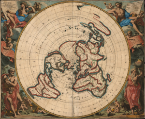
Planisphere terrestre: suivant les nouvelles observations des astronomes.../ Planispherium terrestre: secundum recentiores astronomorum observationes...
$4,250.00
Acquire
- Digital Map Information
- Suitable for large format printing
- File Size: 34.28 MB
- File Type: ZIP / TIFF
- ICC color profile embedded
- Delivered instantly via download link
This beautiful north polar projection map of the world, published in 1713 by Pieter van der Aa, is the most attractive depiction of a lost cartographic monument: Giovanni Domenico Cassini's eight-meter world map, which at one time adorned the floor of the Paris Observatory. That mammoth work can be considered the earliest scientific map of the world: it was the first to fix longitude based upon accurate astronomical observation. The present map is a glorious work of baroque art, embellished by the masterful decorative engravings of Gilliam van der Gouwen, based on the drawings of Jan Goeree. (more details)