
Dawson, Simon James

Simon James Dawson (1818 - 1902) was a Canadian engineer and politician. Born in Scotland, Dawson emigrated to Canada in his youth and was trained as an engineer. He was chosen to join the Canadian government's 1857 Red River Expedition and in 1858 - 1859 surveyed the route of a possible road and conducted explorations between Thunder Bay and Fort Garry. Afterwards, he was tasked with managing the construction of a road (a 'colonization road') along the route he had surveyed which later bore his name. Between the 1870s and 1890s, he joined the Legislative Assembly of Ontario and then the House of Commons of Canada, where he advocated for the rights of native peoples.
Canada's Westward Expansion.
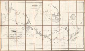
Plan Shewing The Proposed Route From Lake Superior To Red River Settlement...
$1,200.00
Acquire
- Digital Map Information
- Suitable for large format printing
- Full resolution TIFF file
- ICC color profile embedded
- Delivered instantly via download link
A historically significant 1858 map of the Canadian region stretching from Lake Winnipeg and the Red River Settlement to the western shores of Lake Superior. It is based on surveys by Simon James Dawson and William Napier, conducted during a Canadian government-sponsored expedition undertaken the previous year, and was published in Henry Youle Hind's Report on a Topographical and Geological Exploration of the Canoe Route Between Fort William, Lake Superior, and Fort Garry, Red River... The expedition's work, along with a concurrent British-financed expedition over some of the same territory, greatly stimulated interest in both London and Ottawa for Canada's westward expansion, which was realized in the following decades. (more details)