
Deharme, Louis-François

Louis-François Deharme (17?? - 17??) was a French cartographer active in the middle to late 18th century. He held the prestigious position of Geograph de Roy under Louis XV (1710 - 1774).
Spectacular wall map of Paris.
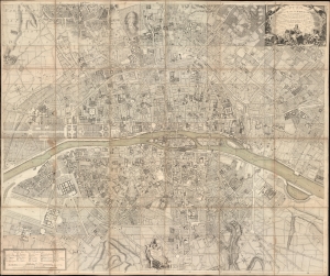
Plan de la Ville et Fauxbourgs de Paris Divise en 20 Quartiers dont la plus grande partie a ete rectifee d'apres differens desseins leve Geometrique, tires du Cabinet de Mr. Cevalier de * * * *... Dedie aux Citoyens de la Capitale Par... Desnos... 1777.
$7,500.00
Acquire
- Digital Map Information
- Suitable for large format printing
- File Size: 265.55 MB
- File Type: ZIP / TIFF
- ICC color profile embedded
- Delivered instantly via download link
This is a spectacular 1777 large-scale map of Paris by Louis-François Deharme, published by Louis Charles Desnos. The map captures Paris during the reign of Louis XV, a period of growing unrest and inter-class resentment that would ultimately culminate in the French Revolution (1789 - 1799). (more details)