
Derfelden van Hinderstein, Gijsbert Franco Baron von

Gijsbert Franco Baron von Derfelden van Hinderstein (July 12, 1783 - May 17, 1857) was a Dutch nobleman and cartographer active in the early to mid-19th century. Von Derfelden was born in Utrecht to Friedrich Johann Baron von Derfelden (1744 - 1808), an officer of Baltic-German nobility from Estonia who enlisted in the Dutch army at the age of 12, and Wilhelmina Elisabeth Henriette van Flodorp (1748- 1823), daughter of a minister from Meerssen near Maastricht. Through his mother, he inherited lordship over Hinderstein and Snellenburg. He exhibited an early proficiency in mathematics and geography, collecting maps and subscribing to geographic and hydrographic journals. In 1815, he became one of just eight nobles of foreign origin to receive a Knighthood of Utrecht. In 1823, at his own request, he was appointed Chamberlain of the King in extraordinary service. He leveraged this relationship to receive a royal commission for a large general map of the Dutch East Indies. For his services to the country for producing this map, the 1842 Algemene Kaart van Nederlandsch Oostindie, he was appointed Knight in the Order of the Netherlands Lion. He dedicated the remainder of his career to scholarly correspondence regarding cartographic matters, including the boundary between Europe and Asia, the sources of the Nile, and the standardization of the prime meridian.
Greatest 19th century map of the East Indies.
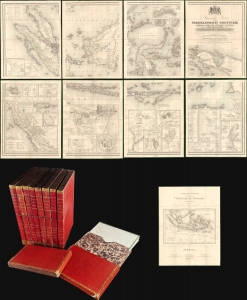
Algemene Kaart van Nederlandsch Oostindie...
$9,500.00
Acquire
- Digital Map Information
- Suitable for large format printing
- Full resolution TIFF file
- ICC color profile embedded
- Delivered instantly via download link
This expansive 1842 8-sheet map of the East Indies compiled by Gijsbert Franco von Derfelden van Hinderstein is the largest and most important map of the East Indies made in the mid-19th century. Compiled from 1820 to 1840, it is the first map to depict the administrative divisions of the Dutch East Indies as the islands progressively came under Dutch administration. The current example is handsomely housed in 9 gilt-stamped leather slipcases. (more details)