
Dollar Weekly Times

The Dollar Weekly Times (185x - 1866) was a weekly independent newspaper published in Cincinnati, Ohio from sometime in the 1850s until it ceased operation in 1866. It was published by Calvin Washburn Starbuck (April 20, 1821 - November 15, 1870). Starbuck was born in Nantucket, Massachusetts and moved to Cincinnati with his family as a child. He apprenticed as a printer, and, at the age of nineteen, he founded the Cincinnati Evening Times in 1840. The newspaper found an audience and became very popular in the area. Starbuck briefly left his business in 1864 after the Governor of Ohio called for volunteers to join the Ohio National Guard Militia and fight in the American Civil War. Starbuck enlisted for one hundred days and served as part of garrison forces in Maryland. After the war, Starbuck remained a prominent citizen in Cincinnati until his death in 1870. Starbuck also founded the Cincinnati Daily Times (the same paper as the aforementioned Cincinnati Evening Times, which survived him and was published until 1879.
Locations of the Union 'Anaconda' blockade of the Confederacy.
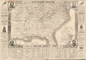
Map of the Southern States, Including Rail Roads, County Towns, State Capitals, County Roads, the Southern Coast from Delaware to Texas Showing the Harbors, Inlets, Forts and Position of Blockading Ships.
$950.00
Acquire
- Digital Map Information
- Suitable for large format printing
- File Size: 67.78 MB
- File Type: ZIP / TIFF
- ICC color profile embedded
- Delivered instantly via download link
This is an 1862 map of the Southern United States during the American Civil War published as a supplement to the pro-Union Cincinnati Dollar Weekly Times. Significantly, the map illustrates the specific locations of Union ships blockading the Confederate coast - a naval strangulation strategy known as the Anaconda Plan. (more details)