
Huddart, Joseph
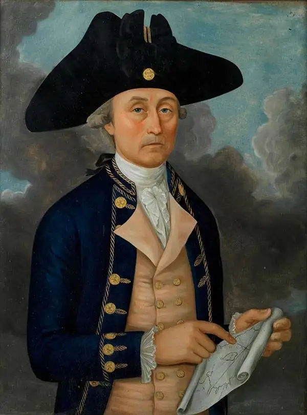
Joseph Huddart (January 11, 1741 - August 19, 1816) was a prominent English sea captain, hydrographer, chartmaker, inventor, and entrepreneur. Born into a fishing family in Allonby, near Maryport in Cumberland, he began his career at sea with his father as a fisherman. By 1762, he commanded the sloop Allonby, carrying cured fish to Ireland for the West Indian market. Later, he designed and built the first ship he would own privately, the Patience, launched in 1768 for the West Indies trade. In 1773, Huddart entered the service of the East India Company as Fourth Officer aboard the York, sailing to St. Helena and Bencoolen. During this voyage, he carried out extensive scientific surveys and observations along the western coast of Sumatra. His efforts came to public notice in 1777 when Robert Sayer published Huddart's charts of the Sumatran coastline and commissioned him to survey St. George's Channel, a project completed in the summer of 1778. The resulting chart, noted for its precision, secured his reputation as one of Britain's foremost hydrographers and ensured his financial success. Later, in 1777, he returned to the East India Company, where he rose to the position of Captain of the Royal Admiral. For nearly ten years, he sailed routes between India and China. In 1786, his chart of the Tigris (Pearl River, China) delta was issued by Robert Sayer. Huddart retired from active service in 1791 but continued to play a central role in maritime affairs. That same year, he was elected a Fellow of the Royal Society, and in 1798, he became one of the founding directors of the East India Dock Company, laying its first foundation stone in 1804. He also served for 25 years as one of the Elder Brethren of Trinity House, offering his expertise on harbor and dock improvements. His inventive work included the three-arm protractor used by hydrographers and a system for using high-water marks in the London docks - a method that remained in practice until the 1960s. Perhaps his most significant contribution to the maritime arts was the development of steam-powered machinery for rope-making, which he transformed into a highly profitable enterprise.
Early nautical chart identifying the British spice trading colony of Bencoolen and Fort Marlborough, Sumatra.
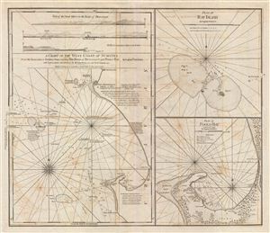
A Chart fo the West Coast of Sumatra from Old Bencoolen to Buffaloe Point containing the Road of Bencoolen and Poolo Bay. Plan of Rat Island. Plan of Poolo Bay.
$1,250.00
Acquire
- Digital Map Information
- Suitable for large format printing
- DPI: 300
- File Size: 22.41 MB
- File Type: ZIP / TIFF
- ICC color profile embedded
- Delivered instantly via download link
This is a fine example of Laurie and Whittle's 1794 nautical chart or maritime map of the west coast of Sumatra in the vicinity of Bencoolen or Fort Marlborough. The map is divided into three sections, the left hand side being a general nautical chart of the ... (more details)