
Loewenberg, Julius

Julius Loewenberg (1800 - December 12, 1893) was a German Jewish printer, geographer, and author active in Berlin during the middle part of the 19th century. Loewenberg was born in the Duchy of Posen. He attended Yeshiva in Kleczewo (Poland) and graduated to the Protestant Gymnasium of Thorn before moving on to study Christian theology and geography at the Universtiy of Berlin. His works include various atlases, histories, and several translations of the works of Alexander von Humboldt, with whom he was apparently close. Loewenberg died in a Jewish retirement home in Berlin.
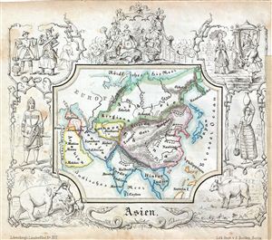
Asien.
$200.00
Acquire
- Digital Map Information
- Suitable for large format printing
- DPI: 300
- File Size: 4.52 MB
- File Type: ZIP / TIFF
- ICC color profile embedded
- Delivered instantly via download link
A delightfully whimsical 1846 map of Asia, from a German kinderatlas or children's atlas. The map covers the all of Asia from Siberia in the north to Ceylon in the Indian Ocean including Philippines and from Arabia in the west to Japan in the east. The whole is ... (more details)
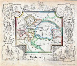
Oesterreiche.
$150.00
Acquire
- Digital Map Information
- Suitable for large format printing
- DPI: 300
- File Size: 4.75 MB
- File Type: ZIP / TIFF
- ICC color profile embedded
- Delivered instantly via download link
A delightfully whimsical 1846 map of Austria, from a German kinderatlas or children's atlas. The map details the Austrian Empire at its peak and covers from Lemberg (Lviv) to Dalmatia with divisions shown by color coding. The whole is surrounded by a wide ... (more details)
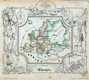
Europa.
$150.00
Acquire
- Digital Map Information
- Suitable for large format printing
- DPI: 300
- File Size: 4.8 MB
- File Type: ZIP / TIFF
- ICC color profile embedded
- Delivered instantly via download link
A delightfully whimsical 1846 map of Europe, from a German kinderatlas or children's atlas. The map details the entire European continent and is divided with color coding into countries. The whole is surrounded by a wide border featuring charming ... (more details)
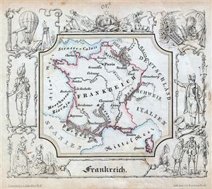
Frankreich.
$150.00
Acquire
- Digital Map Information
- Suitable for large format printing
- DPI: 300
- File Size: 4.65 MB
- File Type: ZIP / TIFF
- ICC color profile embedded
- Delivered instantly via download link
A delightfully whimsical 1846 map of France, from a German kinderatlas or children's atlas. The map details France and Corsica. The whole is surrounded by a wide border featuring charming vignettes meant to illustrate the peoples and cultures of ... (more details)
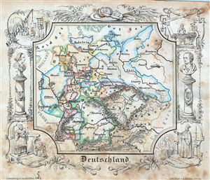
Deutschland.
$100.00
Acquire
- Digital Map Information
- Suitable for large format printing
- DPI: 300
- File Size: 5.62 MB
- File Type: ZIP / TIFF
- ICC color profile embedded
- Delivered instantly via download link
A delightfully whimsical 1846 map of Germany, from a German kinderatlas or children's atlas. The map details Germany from Holstein to Salzburg with divisions shown by color coding. The whole is surrounded by a wide border featuring charming ... (more details)
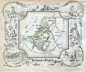
Holland u. Belgien.
$150.00
Acquire
- Digital Map Information
- Suitable for large format printing
- DPI: 300
- File Size: 4.29 MB
- File Type: ZIP / TIFF
- ICC color profile embedded
- Delivered instantly via download link
A delightfully whimsical 1846 map of Holland and Belgium, from a German kinderatlas or children's atlas. The map details the countries of Holland and Belgium with the two countries divided with color coding. The whole is surrounded by a ... (more details)
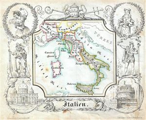
Italien.
$150.00
Acquire
- Digital Map Information
- Suitable for large format printing
- DPI: 300
- File Size: 4.36 MB
- File Type: ZIP / TIFF
- ICC color profile embedded
- Delivered instantly via download link
A delightfully whimsical 1846 map of Italy, from a German kinderatlas or children's atlas. The map covers pre-Garibaldi Italy split into numerous small duchies and city states from Venetian Lombardy south to Sicily with divisions ... (more details)
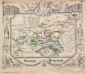
Koenigr. Preussen.
$150.00
Acquire
- Digital Map Information
- Suitable for large format printing
- DPI: 300
- File Size: 4.84 MB
- File Type: ZIP / TIFF
- ICC color profile embedded
- Delivered instantly via download link
A delightfully whimsical 1846 map of Prussia, from a German kinderatlas or children's atlas. The map details the Kingdom of Prussia from Memel to Opplen as far as Aachen in the west with divisions shown by color coding. The ... (more details)
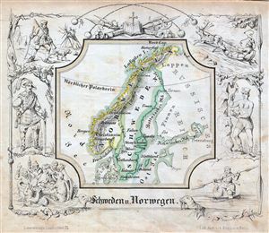
Schweden u. Norwegen.
$150.00
Acquire
- Digital Map Information
- Suitable for large format printing
- DPI: 300
- File Size: 4.65 MB
- File Type: ZIP / TIFF
- ICC color profile embedded
- Delivered instantly via download link
A delightfully whimsical 1846 map of Scandinavia, from a German kinderatlas or children's atlas. The map details Sweden and Norway divided with color coding. The whole is surrounded by a wide border featuring charming ... (more details)
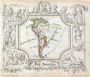
Sud Amerika.
$150.00
Acquire
- Digital Map Information
- Suitable for large format printing
- DPI: 300
- File Size: 4.57 MB
- File Type: ZIP / TIFF
- ICC color profile embedded
- Delivered instantly via download link
A delightfully whimsical 1846 map of South America, from a German kinderatlas or children's atlas. The map covers the entire continent from Panama to Cape Horn with countries divided with color coding. The whole is ... (more details)
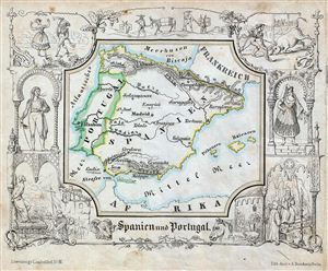
Spanien und Portugal.
$150.00
Acquire
- Digital Map Information
- Suitable for large format printing
- DPI: 300
- File Size: 4.64 MB
- File Type: ZIP / TIFF
- ICC color profile embedded
- Delivered instantly via download link
A delightfully whimsical 1846 map of Spain and Portugal, from a German kinderatlas or children's atlas. The map details Spain and Portugal. The whole is surrounded by a wide border featuring charming vignettes ... (more details)
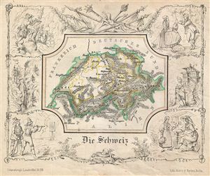
Die Schweiz.
$150.00
Acquire
- Digital Map Information
- Suitable for large format printing
- DPI: 300
- File Size: 4.7 MB
- File Type: ZIP / TIFF
- ICC color profile embedded
- Delivered instantly via download link
A delightfully whimsical 1846 map of Switzerland, from a German kinderatlas or children's atlas. The map covers all of Switzerland from Germany and France to Italy. The whole is surrounded by a wide border ... (more details)